Tropical Storm Fred Forms; Appears Unlikely To Impact Land
The Atlantic basin’s sixth named storm of the season has developed, however, Tropical Storm Fred’s projected path should keep it from U.S. or Caribbean interests, although the storm bears continued watching.
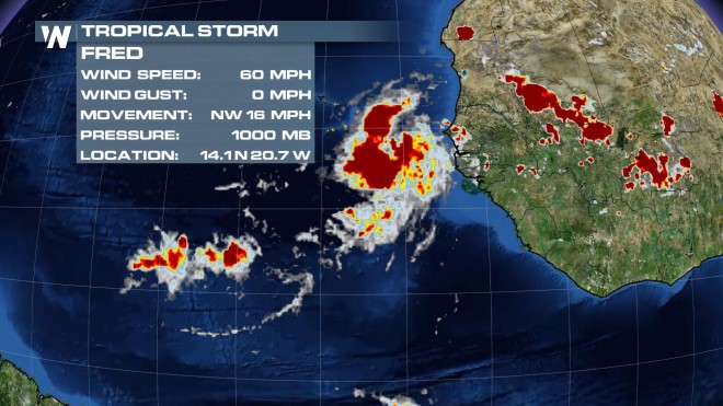
Tropical Storm Fred formed on Saturday just off the west African coast, near the country of Guinea, and as of late Sunday afternoon, the storm’s 65 mile-per-hour (MPH) maximum sustained winds had it just 9 MPH short of developing into the Atlantic’s second hurricane so far in 2015. Hurricane warnings have been posted for the Cape Verde Islands off the west African coastline, as Fred is expected to intensify into a hurricane over the next 24 hours and move in the islands’ general direction.
However, after possible interaction with the Cape Verde Islands, Fred’s path is expected to take a more northward turn over the next two-to-four days, one that should bring it both away from warmer waters further south and away from a big steering area of high pressure over the central Atlantic. If Fred is able to turn far enough north, as several models are suggesting, the storm should move into the central Atlantic and mostly stay out to sea and likely weakening as it does so. That said, some of the models also attempt to take Fred on more of a westerly jog, one that could eventually steer it – over a week from now – towards the western Atlantic and make it a system that could threaten land, if Fred were to survive a seven-to-10 day journey across the Atlantic. For now, however, the track appears to favor more of a northward tilt and cooler sea surface temperatures along with increased wind shear, two factors that should combine to gradually weaken the system into the middle of the week.
Stay with WeatherNation for the latest on Fred and the tropics.
For WeatherNation: Meteorologist Chris Bianchi