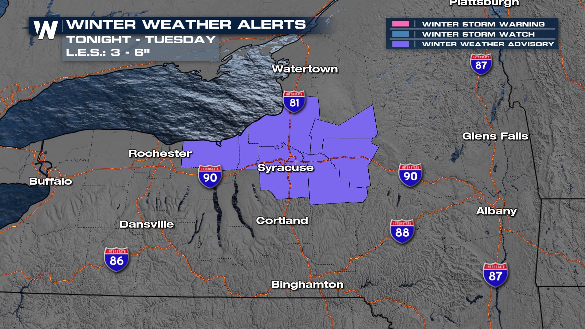
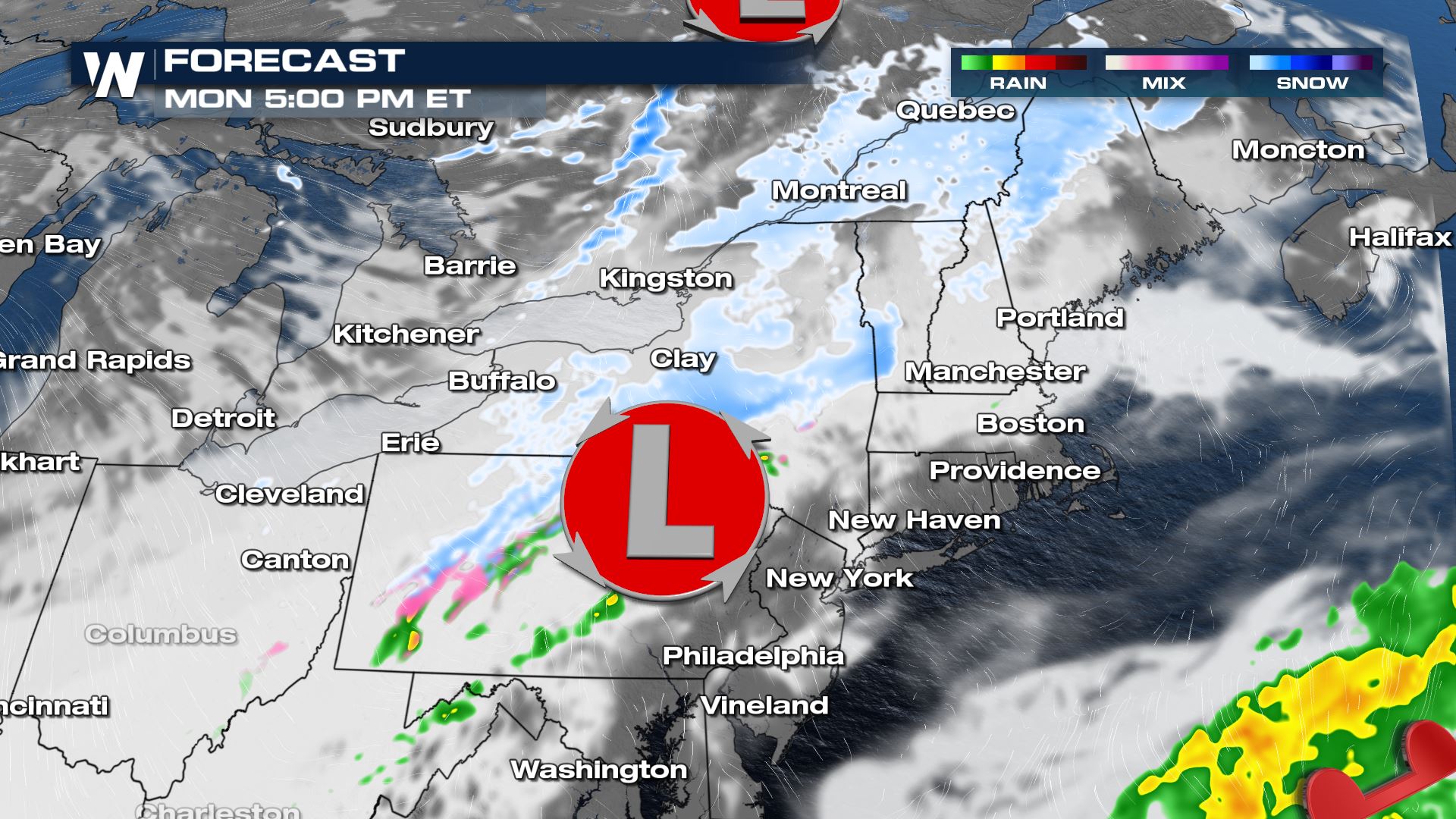
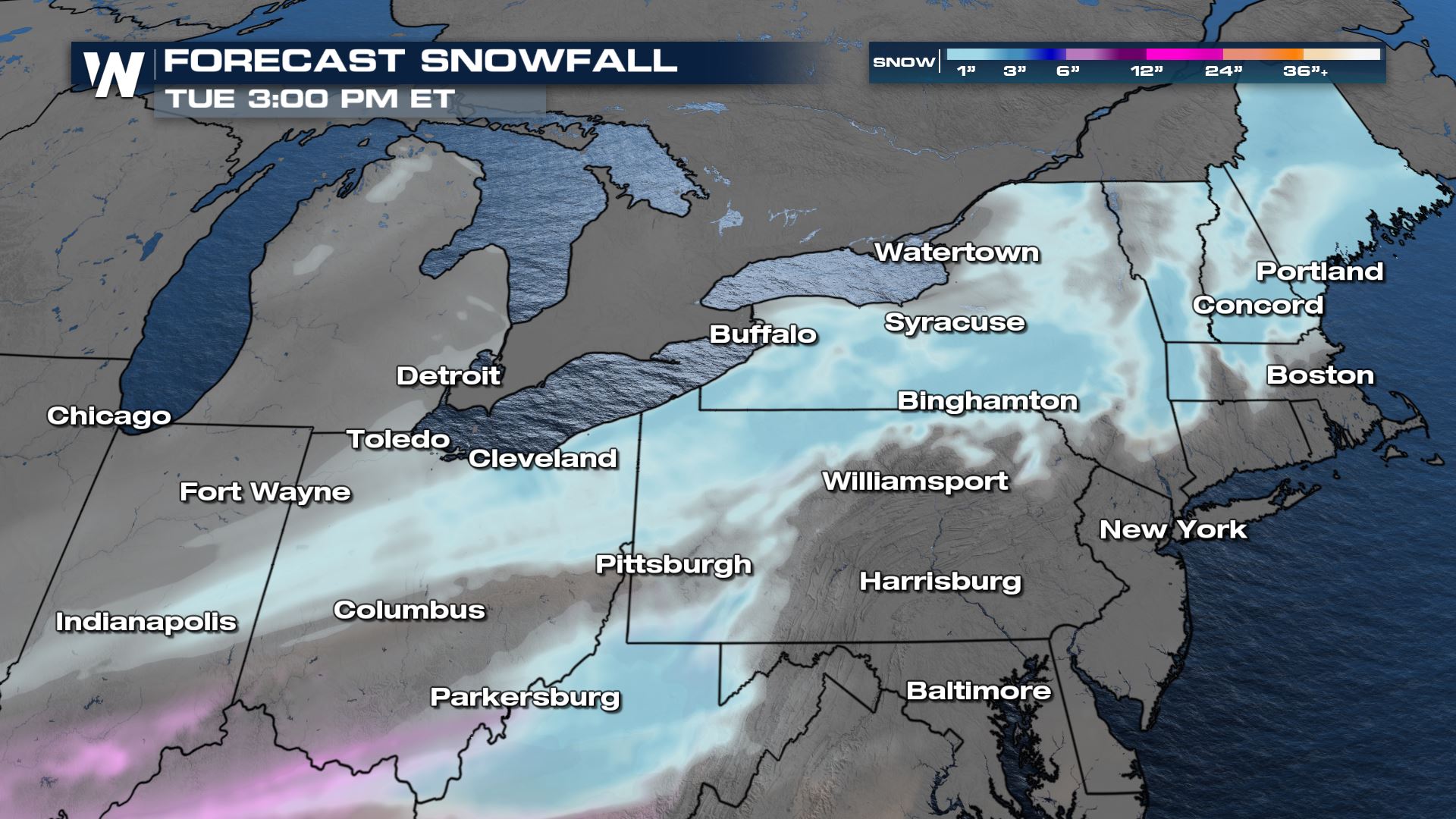
Additional waves of energy will be coming out of the Great Lakes through Monday, bringing light precipitation chances through the northeast. Winter alerts have been issued from Central New York back into the Midwest for light snowfall this morning. While we see light snow around the Midwest Monday morning, the heaviest of the snowfall will be through the Northeast Monday night and early Tuesday morning.
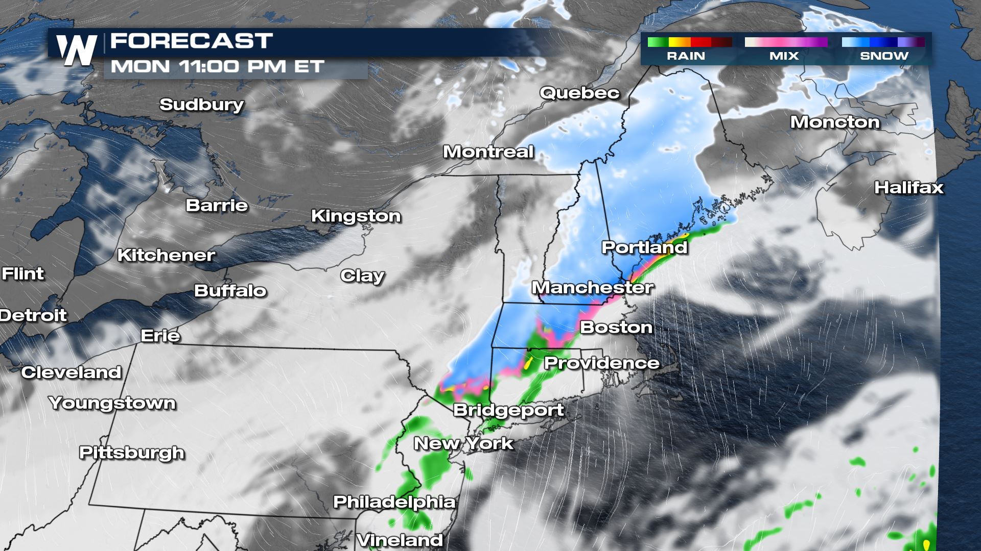
Additional snowfall will be highest through the Tug Hill Plateau and northern New England. Due to the slightly warmer makeup of the late weekend storm system, there will be more rain than snow so most won’t accumulate.
Stay with WeatherNation for updates on the wet weather chances in New England and the Northeast this weekend. Also, the Eastern Regional Forecast is always :10 past the hour.