Wildfires Rage On; Forecasting Welcome Rain For Southern California
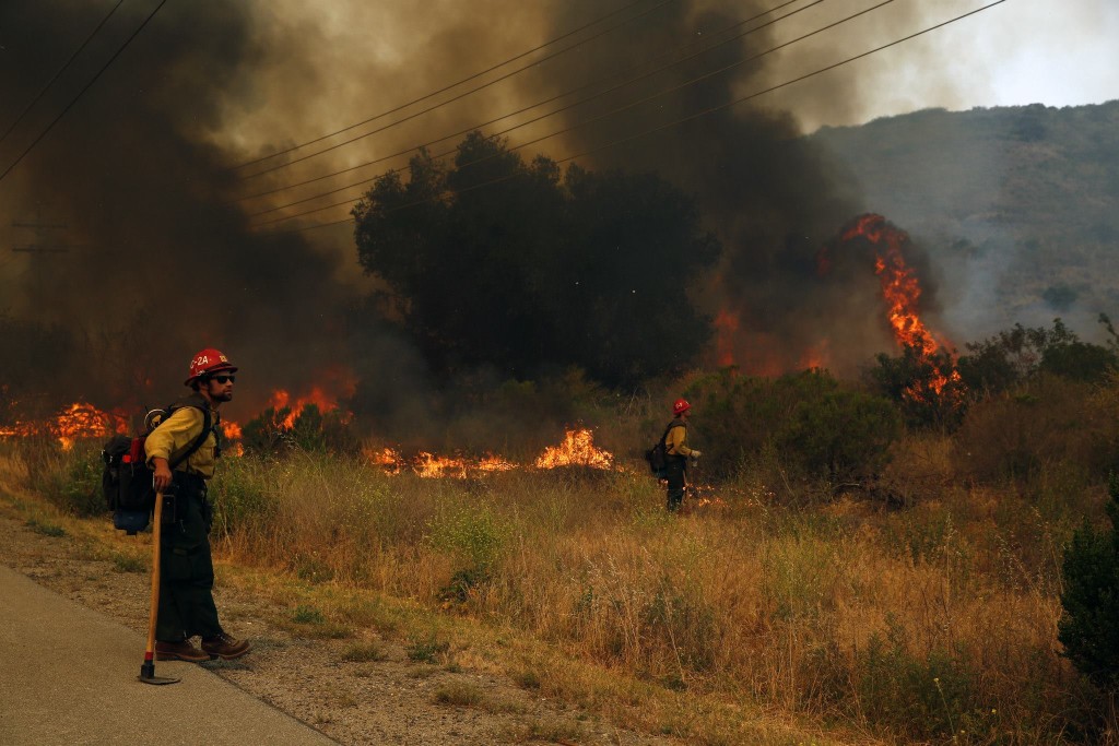

Our friends in Southern California were thrust into the national spotlight this past week as numerous wildfires sprung up and charred thousands of acres. After 2013 wrapped up as the driest year on record, it’s no surprise that the entire state is basically a tinderbox, but these fires are uncharacteristically early. CalFire’s PIO Daniel Berlant shared this stat a few days ago that I still can’t get over:
Since Jan 1 @CAL_FIRE has responded to over 1,350 wildfires. Average for this time of year is 700. Prevent wildfires. #OneLessSpark
— CAL FIRE PIO Berlant (@CALFIRE_PIO) May 13, 2014
Check in with CAL FIRE for status reports on all California wildfires: http://www.fire.ca.gov/
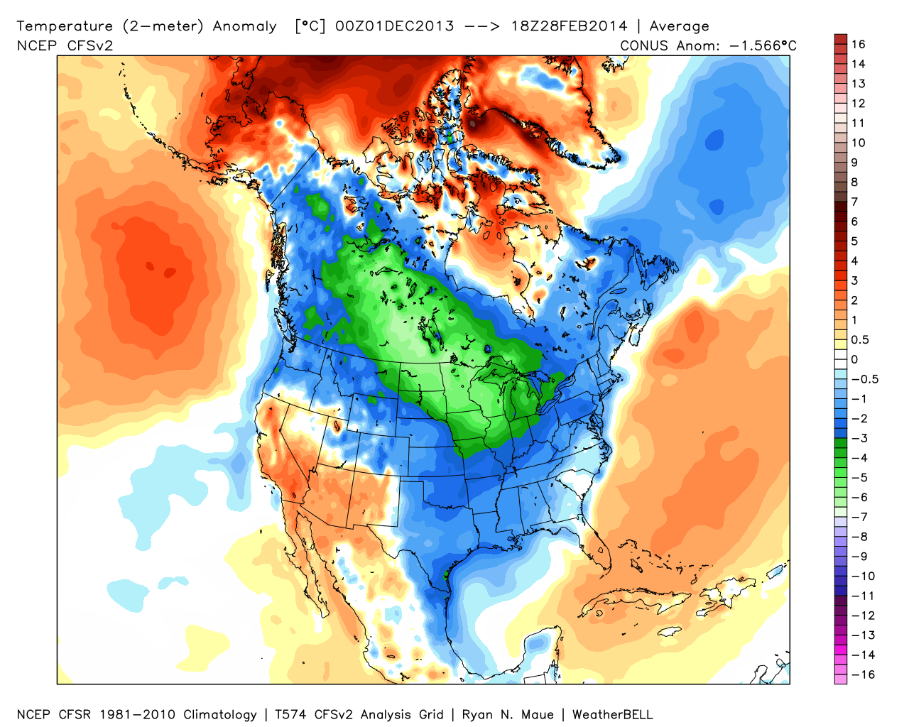
Recent record heat, fueled by Santa Ana winds, made matters worse. Overall, temperatures in the Southwest have been at least above-average for the past three months straight. See map below, courtesy WeatherBell.com:
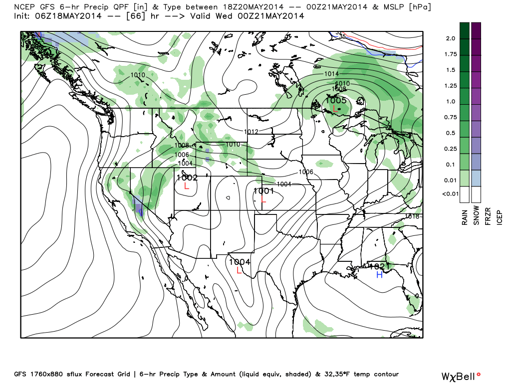
Good news though! Cooler air will move in from the north this week, bringing with it a good shot at some much-needed rain & even some Sierra mountain snow.
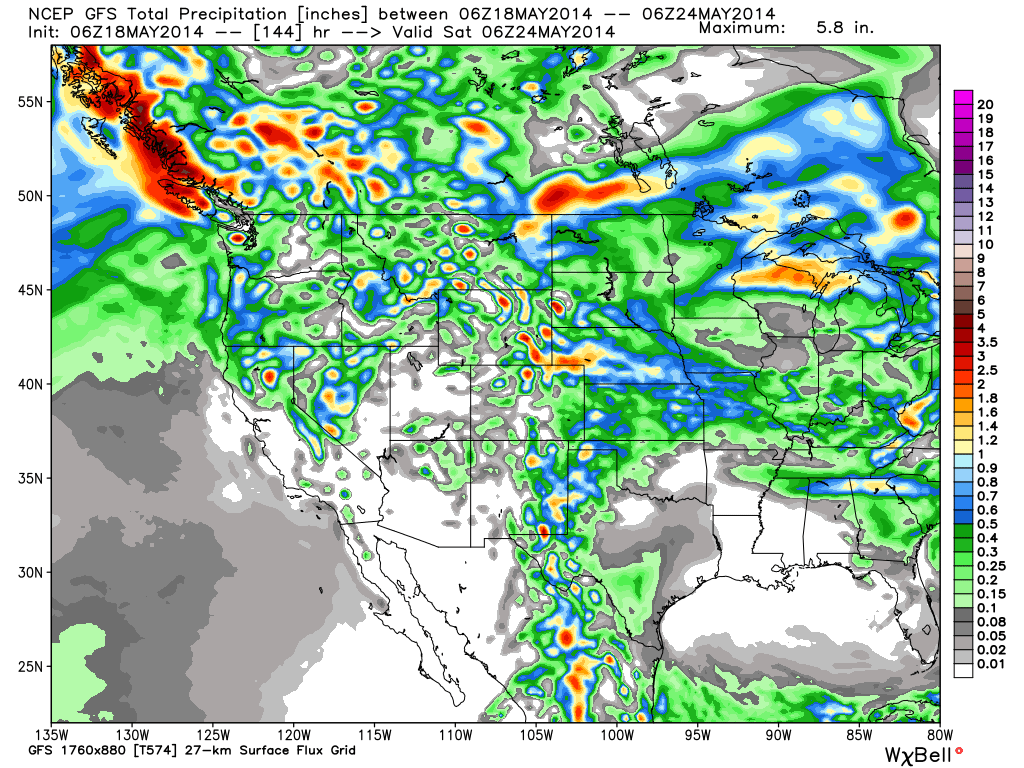
This forecast shows precipitation headed for central California by mid-week (Tuesday night – Wednesday morning). Total accumulation through Friday night won’t be a ton, but any little bit helps!
Cross your fingers and hope for rain! And hope all the firefighters stay safe in SoCal while battling these blazes. We’ll have more on this (and other top weather stories) here at WeatherNation — be sure to tune in for the latest! -Meteorologist Miranda Hilgers
Follow me on Facebook! www.facebook.com/MeteorologistMirandaHilgers
Follow me on Twitter! www.twitter.com/mhilgersWNTV