Shifting Gears: New England Chill – Central USA Warms Up – California Cooling Trend

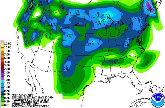
7-Day Predicted Rainfall Amounts. NOAA model ensembles show some .5″ rains for drought-stricken Texas, as much as 1″ from Des Moines and the Twin Cities to Pittsburgh and Albany. Lake Tahoe and far northern California will see significant rain, but none is predicted from the Bay Area to San Diego.
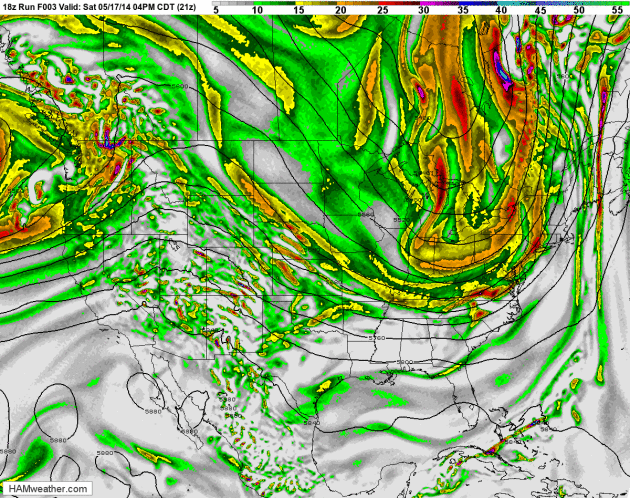
A Jet Stream Correction. 500 mb forecast winds (above) show a ridge of high pressure expanding warm air across the central USA over the next 84 hours, a storm pinwheeling into the west coast, but precious little rain is forecast to fall from California to Texas. New England gets off to a chilly start to the week, but moderation is likely by late week. Winds aloft and 500 mb vorticity: NOAA NAM model and HAMweather.
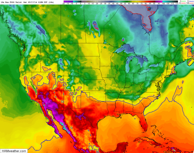
Developing Omega Block? In the coming 7-10 days upper level winds over North America may vaguely resemble the Greek letter omega, cool and stormy weather persisting over New England and the Pacific Northwest, a ridge of warm high pressure sandwiched (and temporarily stalled) in-between. Surface temperatures courtesy of NOAA’s NAM model and HAMweather.
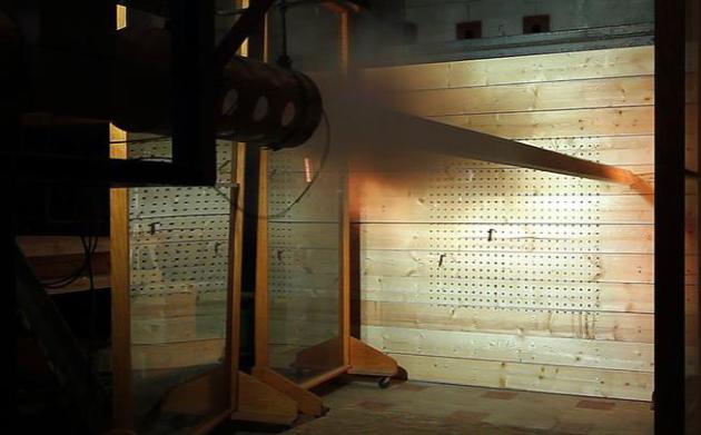
Shelter From The Storm: Cannon Blasts Test Walls for Tornado Safe Rooms. I had no idea this was going on in Madison, Wisconsin. Here’s an excerpt from a story at The Milwaukee Journal-Sentinel: “Shooting two-by-fours out of a cannon seems like a waste of perfectly good wood, but a lot can be learned from splinters that might one day save people from a tornado’s deadly debris. And to frightened folks freaking out in the middle of a tornado, it doesn’t matter what researchers do to ensure their safety, they just want to survive. In a large building at the Forest Products Laboratory in Madison, researchers are trying to simulate the effects of debris whipped by twisters. To do that, they are re-creating 250-mph winds that suck up everything in a tornado’s path and fling it in all directions…”
Photo credit above: Gary Porter. “A two-by-four is shot out of a cannon to simulate debris being whipped about by 250-mph winds, during testing at Forest Products Laboratory in Madison.”
______________________________________________________________

Welcome to the WeatherNation blog. Every day I sift through hundreds of stories, maps, graphics and meteorological web sites, trying to capture some of the most interesting weather nuggets, the stories behind the forecast. I’ll link to stories and share some of the web sites I use. I’m still passionate about the weather, have been ever since Tropical Storm Agnes flooded my home in Lancaster, PA in 1972. I’ve started 5 weather-related companies. “EarthWatch” created the world’s first 3-D weather graphics for TV stations – Steven Spielberg used our software in “Jurassic Park” and “Twister”. My last company, “Digital Cyclone”, personalized weather for cell phones. “My-Cast” was launched in 2001 and is still going strong on iPhone, Android and Blackberry. I sold DCI to Garmin in 2007 so I could focus on my latest venture: WeatherNation. I also write a daily weather column for The Star Tribune startribune.