Severe Weather Threats Continue This Week

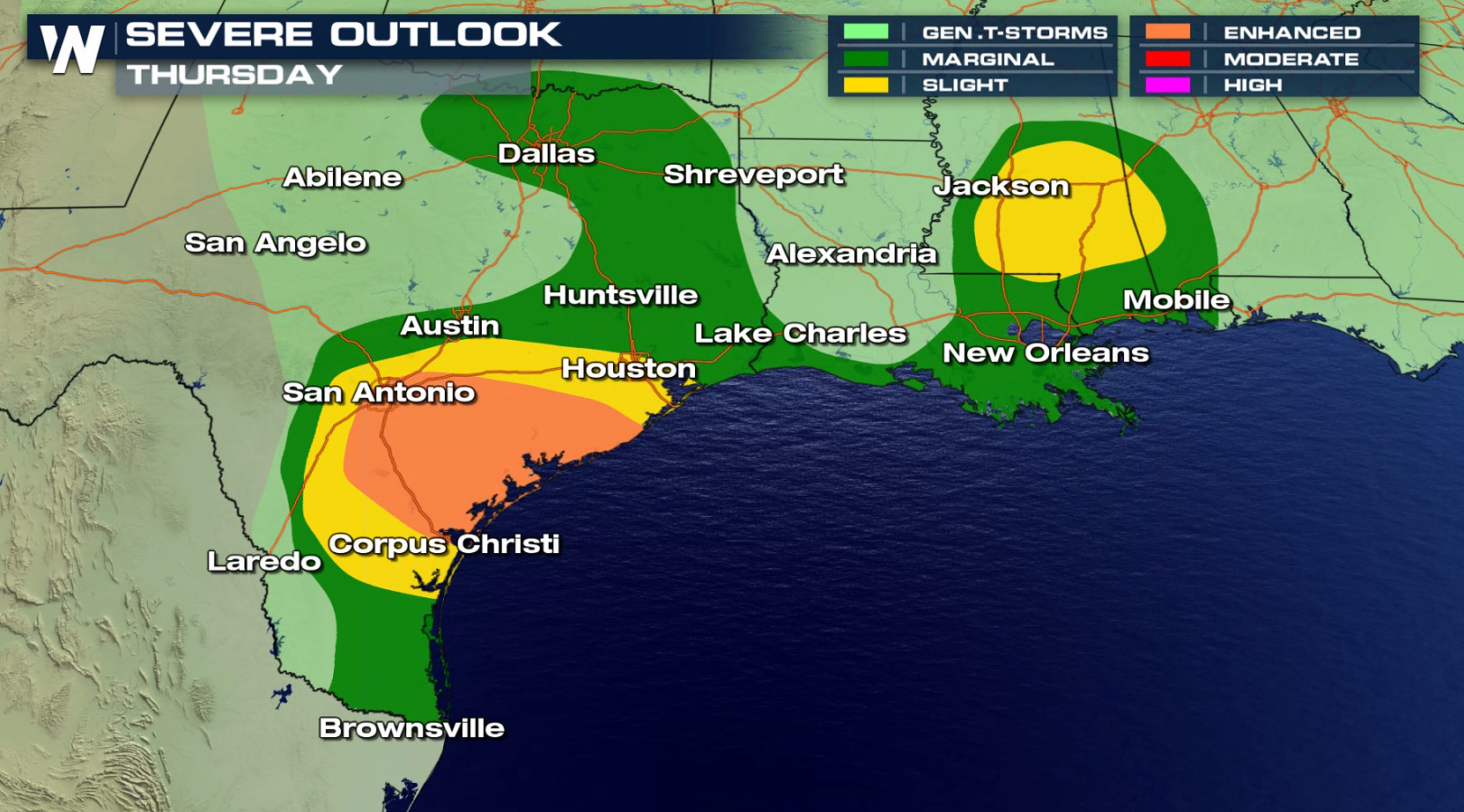
Severe weather season continues to be an exceptionally busy one, and the next several days will offer up more severe weather threats. For today (Thursday), the severe weather risk area extends along the Gulf of Mexico coastline. You can read more about it here at this link.
The risk for severe thunderstorms on Friday shifts into the Upper Midwest, along with a lowered threat along the Gulf of Mexico coast from Texas and Mississippi.


Most of the storms will fire up during the afternoon and evening hours. Damaging winds and hail will be possible, along with isolated tornadoes. Here’s what future radar looks like for Friday afternoon and evening:


The risk for severe thunderstorms on Saturday shifts into the Upper Midwest and in the Southeast.

There’s another threat that must not be discounted, heavy rain! Many of these storms will produce rainfall at rates of 1 to 2 inches per hour. And many areas have already seen too much rain. Flooding is a huge on-going problem in many places, especially across Oklahoma and Arkansas. Additional rainfall in these areas will only serve to exacerbate the flooding problems.

For complete severe weather coverage, stay tuned to WeatherNation TV. You can watch on the Dish Network, Roku, Fire TV, Apple TV, Pluto TV, and on all mobile devices with the free WeatherNation App.
For WeatherNation: Meteorologist Matt Monroe