A storm is shaping up later this week that could potentially touch off severe thunderstorms across the Lower Mississippi & Ohio Valleys.
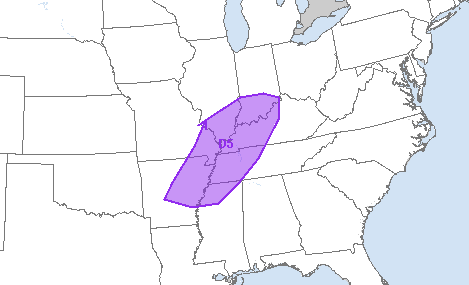
The Storm Prediction Center (a part of the National Weather Service) has already issued a risk alert for Day 5 (Thursday evening). This zone, shaded in purple, is the area most likely to experience strong thunderstorms.
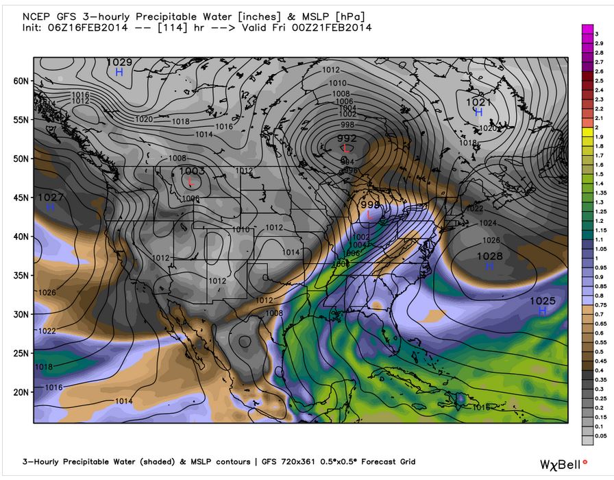
Where did this come from? Well, the most recent weather model output shows a storm forming and approaching the area with a fair amount of strength. This is very much a spring set-up, featuring a low-level jet and the open, moist flow of the Gulf of Mexico.
[Image above courtesy WeatherBell Analytics]
This forecast above is showing the storm system (red L in lower Michigan) and the precipitable water in the atmosphere, (the moisture available for rainfall). As a cold front swings through this warm, moist air, it will provide some vertical lift for thunderstorm development. (Forecast above is valid for Thursday evening.)
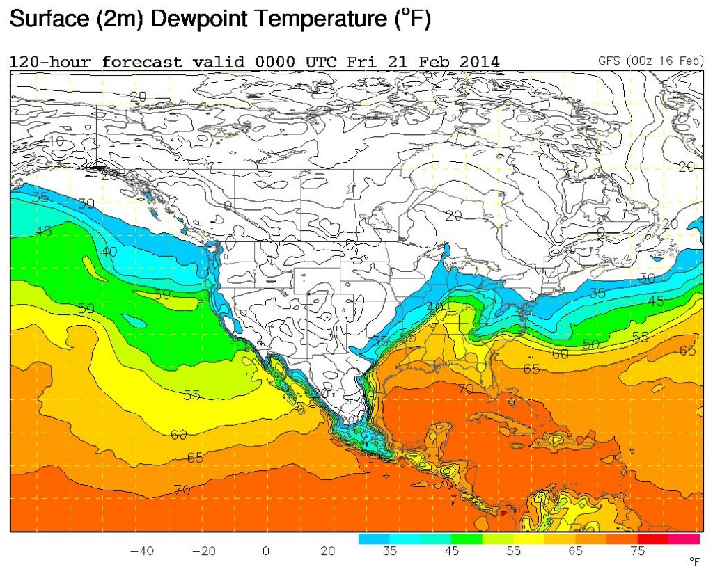
[Image above courtesy UCAR/NCAR]
Warm, moist air will be in place all the way down to the surface of the earth. This forecast above is also valid for Thursday evening, and shows dewpoints well into the 60s for much of the southeast. Dewpoints in the 60s become noticeably humid, and dewpoints in the 70s become downright muggy.
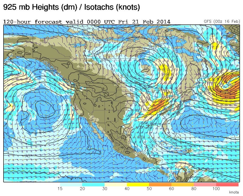
[Image above courtesy UCAR/NCAR]
The collision of air masses above will get a little extra oomph from a low-level jet that will aid in bringing the warm & moist air northward from the Gulf of Mexico. The forecast above (valid Thursday night) shows a zone of strong southerly wind in the Ohio Valley. The wind speeds here will likely exceed 60 mph (sustained).
We’ll be watching this potential storm closely, so stay tuned for continued updates as the forecast evolves. Thanks for stopping by, and have a great week! -Meteorologist Miranda Hilgers (@mhilgersWNTV)


