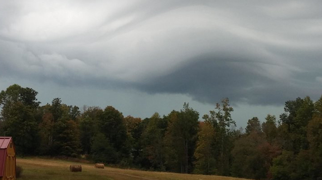
Photo credit: Mary in Red Bolling Springs. TN
Most people typically associate severe weather season with April and May, but there’s often a lesser-known ‘secondary peak’ in the fall months, and it unfortunately looks likely to spawn the potential for severe weather early next week.
A strong low looks poised to form in the lee of the Rocky Mountains on Sunday night, and that low will trek right across the heart of the country on Monday, triggering widespread showers and storms and the potential for severe weather as well.
Storms will start in north Texas and in Oklahoma late on Sunday night and through the overnight hours and into early Monday, and by Monday a potent line of storms pushes into the lower Mississippi River valley, threatening cities such as Little Rock, Arkansas, Memphis, Tennessee and Jackson, Mississippi on Monday and Atlanta, Georgia, Birmingham Alabama and Knoxville, Tennessee on Tuesday.
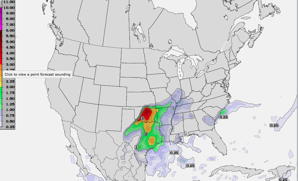
The nastiest of storms could take place during the overnight hours on Sunday night and into early Monday for central and eastern Oklahoma along with northeast Texas, where tornadoes could be an overnight threat in this region. On Monday and Tuesday, the strong cold front will go through the Southeast from west-to-east, bringing a threat for strong, damaging winds, hail and isolated tornadoes once again. Courtesy of twisterdata.com, here’s a look at the helicity (a good indicator of the twist in the atmosphere) overnight Sunday and into Monday morning – note the dark reds, which indicate of sharp twist in the atmosphere over Oklahoma:
We’ll keep you posted on the ongoing threat for severe weather right here on www.WeatherNationTV.com and on WeatherNation.
Meteorologist Chris Bianchi