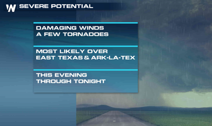
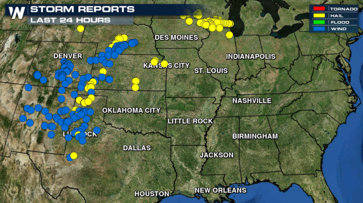
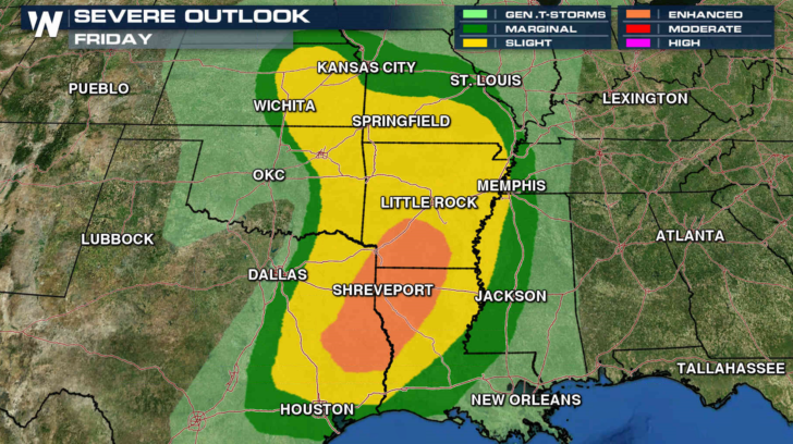
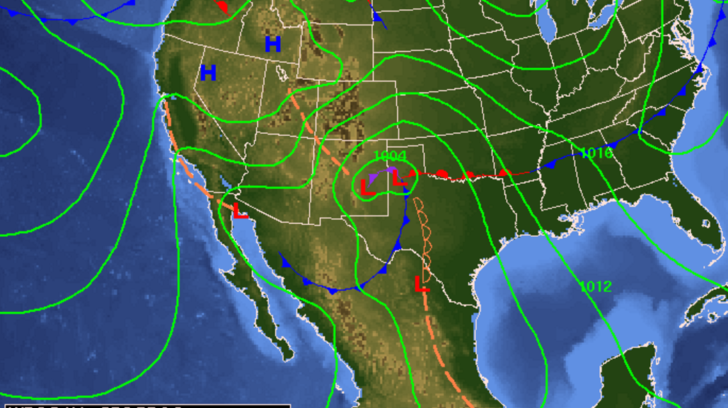
Severe weather chances will be ramping up into early next week as a series of storms systems will affect the Plains and South. Severe storms in the last 24 hours produced dozens of reports of large hail and strong winds. For tonight, an enhanced risk of severe weather has been outlined by the Storm Prediction Center in the Arklatex region, with a slight risk throughout a wide area in the Plains.
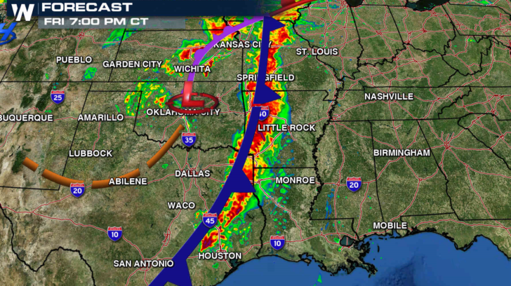
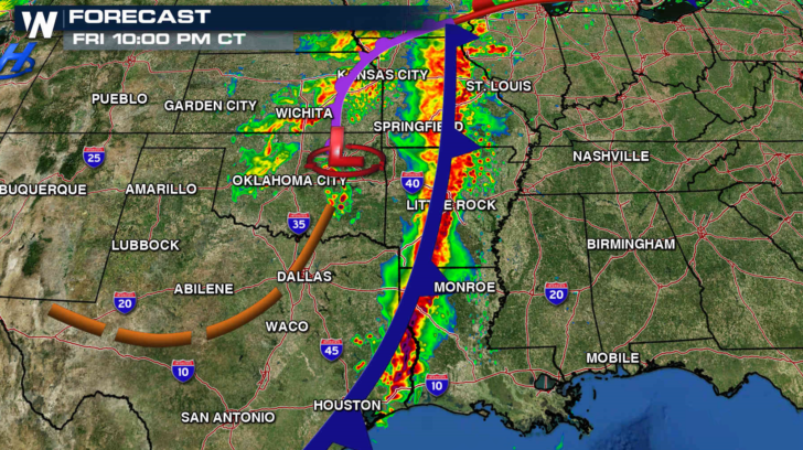
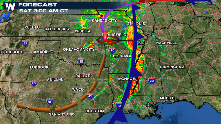
There is a risk for tornadoes this evening, with chances for wind damage increasing later tonight and continuing through the overnight. An increase in the southerly flow off the Gulf of Mexico will enhance the severe weather risk.
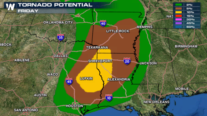
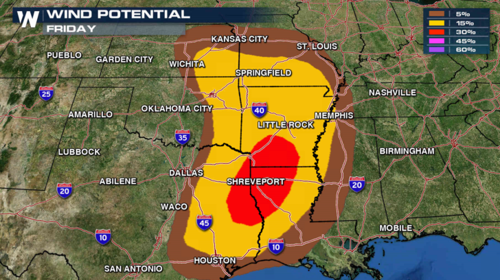
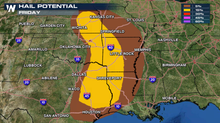
A strong cold front will move eastward tonight with a squall line developing. Isolated tornadoes may develop out ahead of the line this evening, with wind damage possible as the line surges eastward overnight.
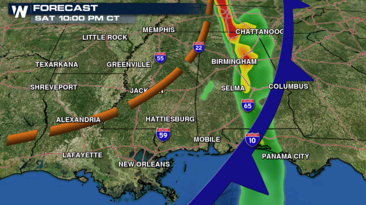
On Saturday, a slight risk for severe storms is in the forecast for Western Tennessee, Eastern Louisiana, Mississippi and Alabama. The squall line may produce some isolated strong winds in the morning, with additional development likely in the afternoon.
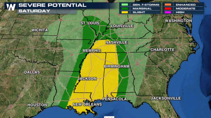
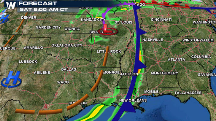
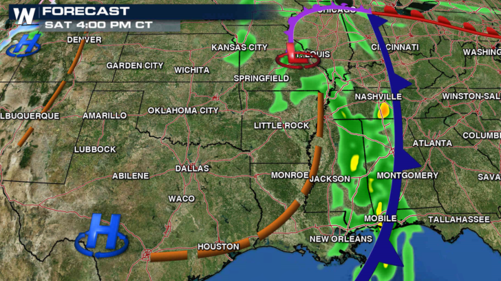
The low pressure center will begin to lift to the north and the cold front will lose its support. The storms will likely weaken during the midday, with less development in the afternoon. Further north in the Tennessee Valley, severe storms are possible into the evening.
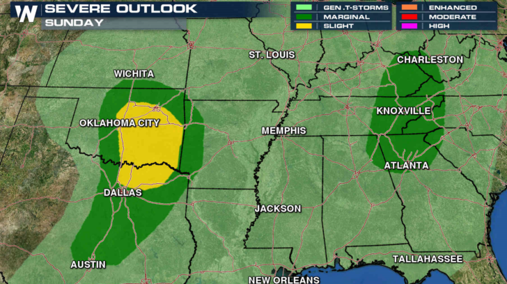
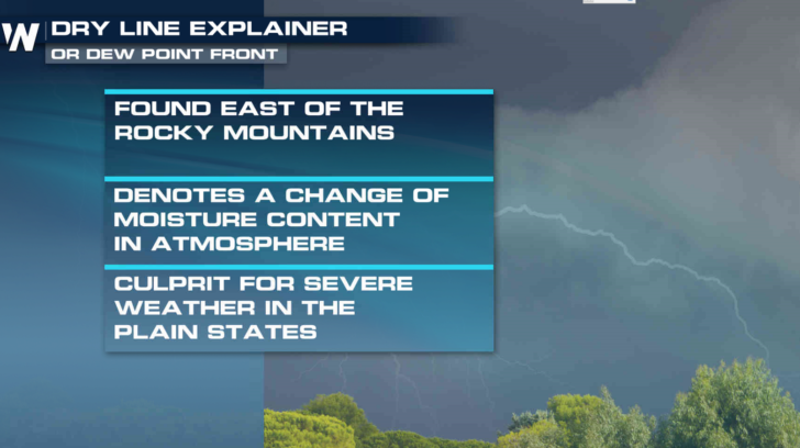
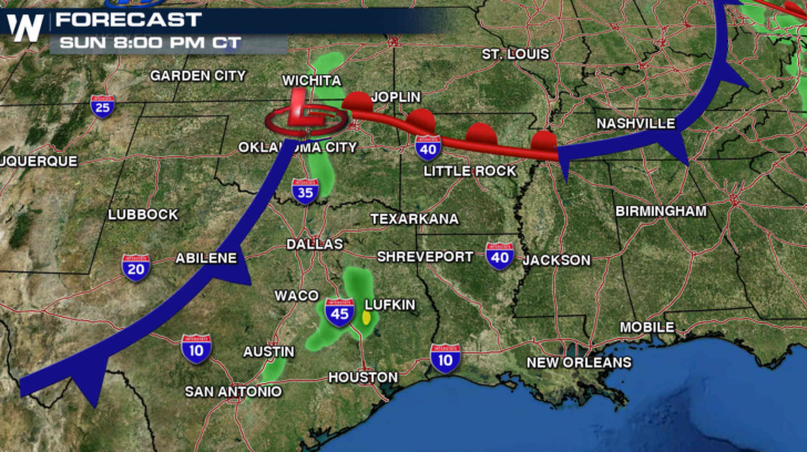
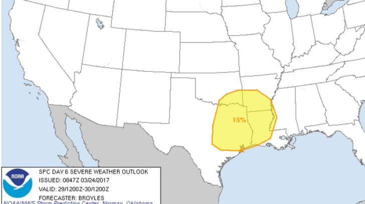
On Sunday, another system will enter the Southern Plains from the Four Corners. A dry line will develop in the morning and slide to the east. Severe storms are likely to develop along the dry line in the late afternoon and evening hours, with strong wind gusts and isolated tornadoes.
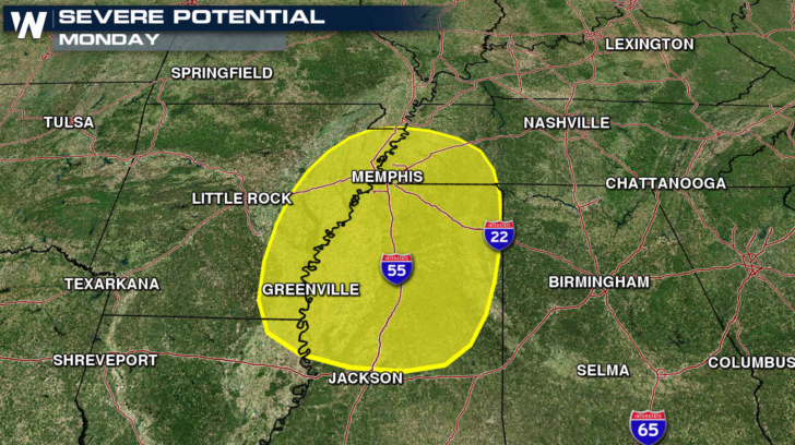
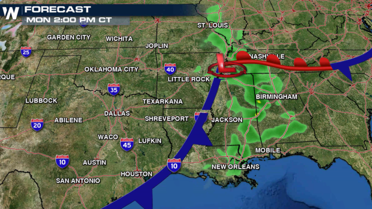
Severe weather possibilities continue on Monday as the cold front and low pressure center tracks to the east. Wind shear is forecast to be higher ahead of the low with instability increasing with a flow off the Gulf of Mexico.
Another low pressure center will move into the region Tuesday, pulling out of the Southwest and into Texas. A dry line is expected to develop once again, producing severe weather.
For Wednesday, the lead low pressure center will slow down as another low moves into the region from near the Four Corners. As the systems merge, the dry line will strengthen with humidity increasing ahead of the storm with a southerly flow off the Gulf of Mexico. Severe weather possibilities will once again focus near the Arklatex region.
For WeatherNation: Meteorologist Mace Michaels