All Weather News

Severe Risk for the Appalachians Overnight

1 May 2022, 7:15 pm

A trough swinging across the Great Lakes will be the focus for severe storms overnight over areas of the The Ohio River Valley.

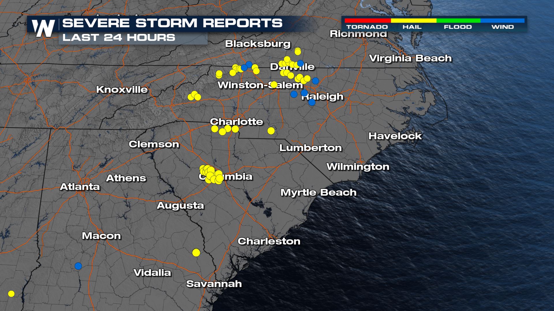
Hail reports have been up to ping pong ball in size on Sunday for parts of North Carolina. Take a look at where the severe reports were located and how large they were.

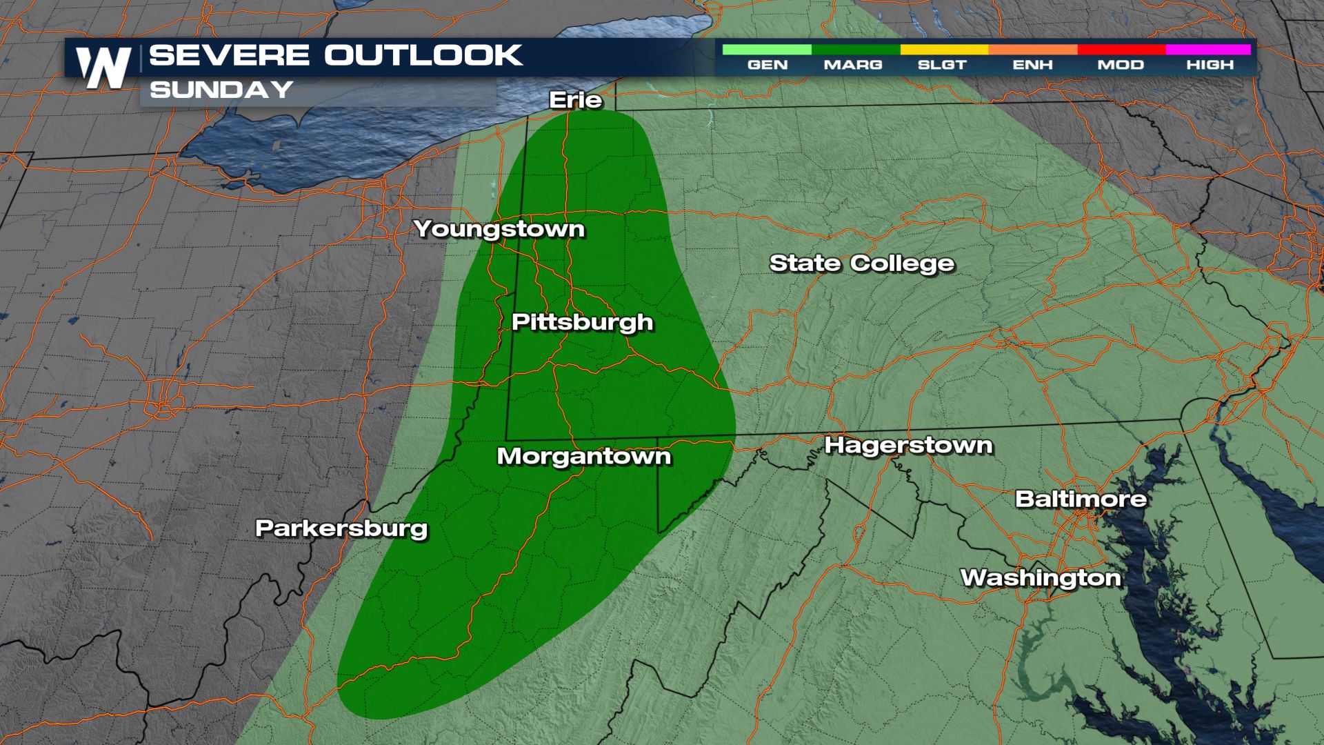
Here is a look at the latest severe forecast.

Severe Outlook – Overnight

The severe risk will be ongoing throughout Sunday over the Appalachians and should keep moving east to the Atlantic Coast by tonight and tomorrow.
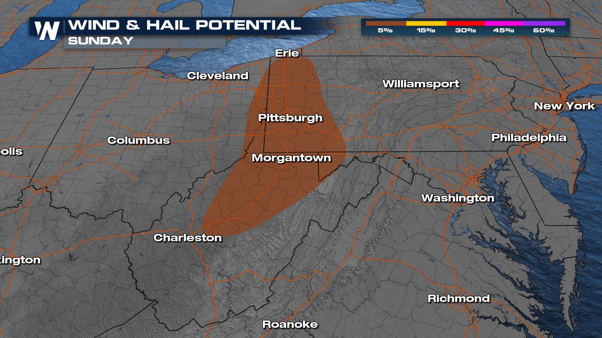
Severe Risks

Wind and Hail will be likely within any of the storms that develop through this region.
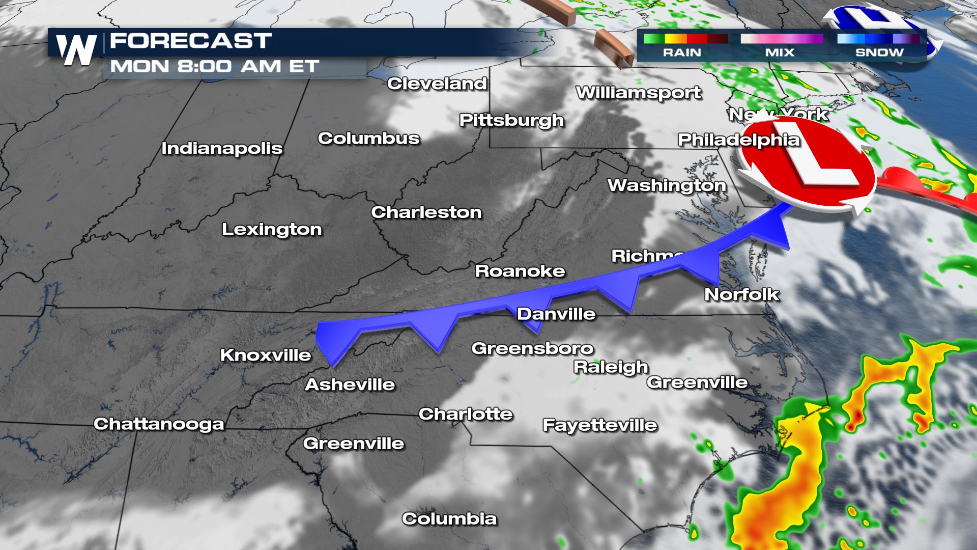
Forecast Timing

Through the overnight hours, the strongest of the storms will continue to track east along the occluded front.

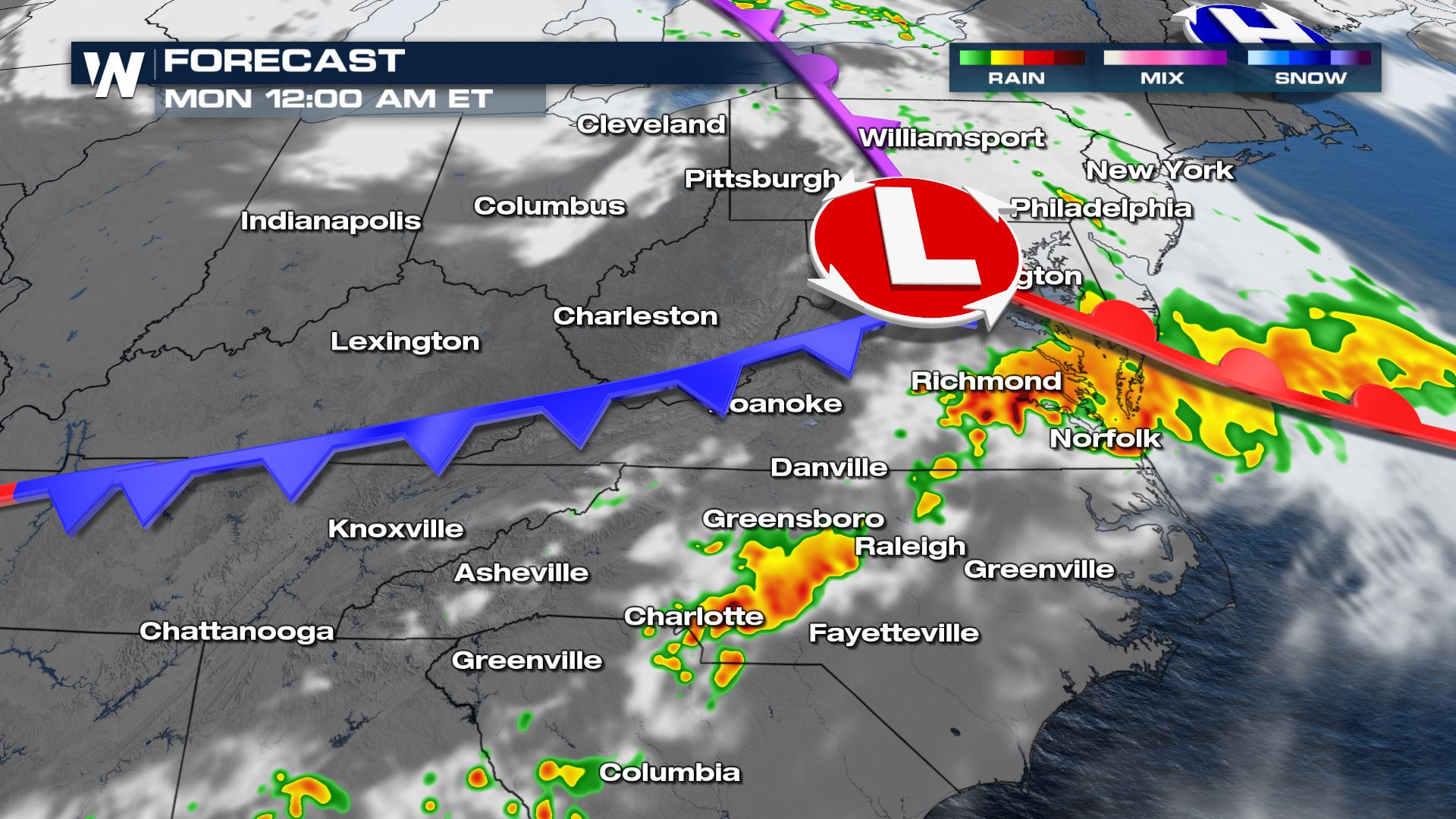
By Monday morning, storms should have moved off the coast through the Mid-Atlantic region.
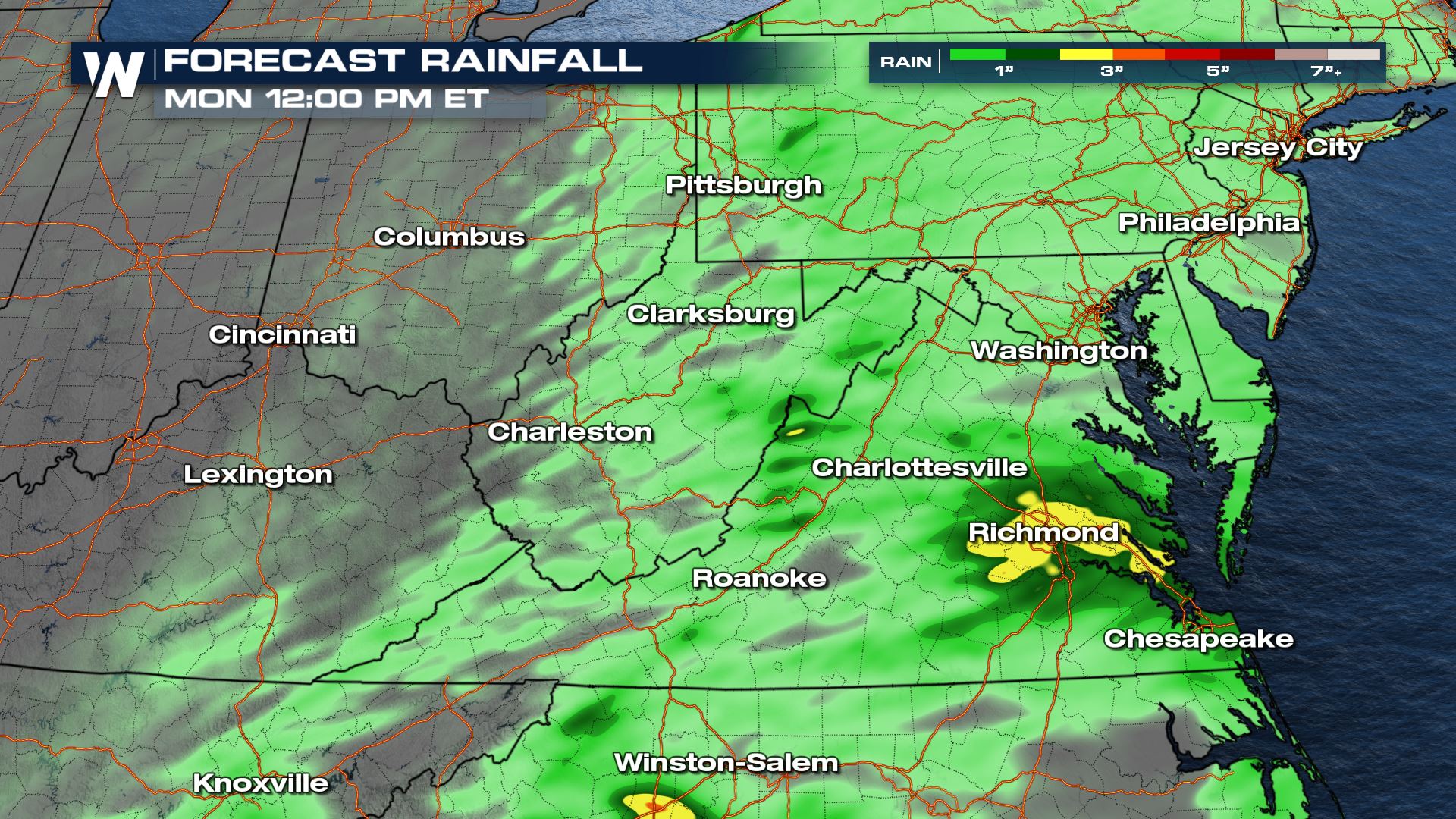
Accumulation

Widespread, rain looks to accumulate up to 2″ – localized areas, including the Richmond location, could see 3″+ which would lead to isolated areas seeing flash flooding.

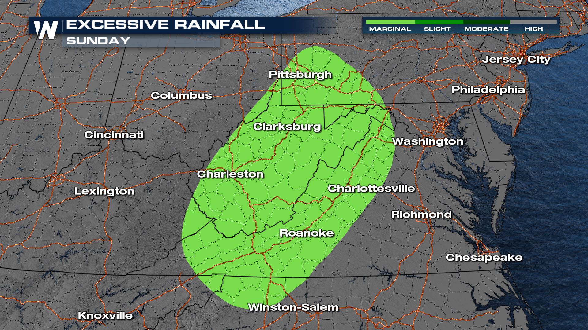
The excessive rainfall outlook shows where flooding could be more likely with the combination of saturated soils and the heavy rain on the way.

Stay with WeatherNation as we bring you the latest on the severe storm chances through the weekend.

About the author
Alana Cameron was born and raised in Canada in the city of Mississauga, just outside of Toronto. Alana is the oldest of 4 siblings, all close in age, and grew up playing outside with them in all types of weather. After graduating high school, Alana moved to study at the University of British Columbia in Kelowna for a year before transferring to Dalhousie University in Halifax, Nova Scotia where sh... Load Moree completed a Bachelor of Science in Physics and Atmospheric Science. Upon completion, Alana moved back to Toronto where she completed a post-grad degree in Meteorology at York University. After her post-grad, she went on to complete another post-grad in Broadcast Journalism - TV News at Fanshawe College in London, Ontario. During her final year of studies she had the privilege of interning with the best in the business in Canada at The Weather Network. Once she finished her internship, she got the call from small-town Denison, Texas where she accepted a job as an on-air meteorologist at KTEN-TV, right in tornado alley, covering severe weather from Sherman/Denison (North Texas) to Ada (Southern Oklahoma). After the most active tornado season Oklahoma had seen in May 2019 (105 tornadoes!) Alana is excited to join WeatherNation to cover weather all across the nation. If you're interested in following her on social media she can be found @alanacameronwx!