Multiple Rounds of Severe Storms for the Front Range of the Rockies
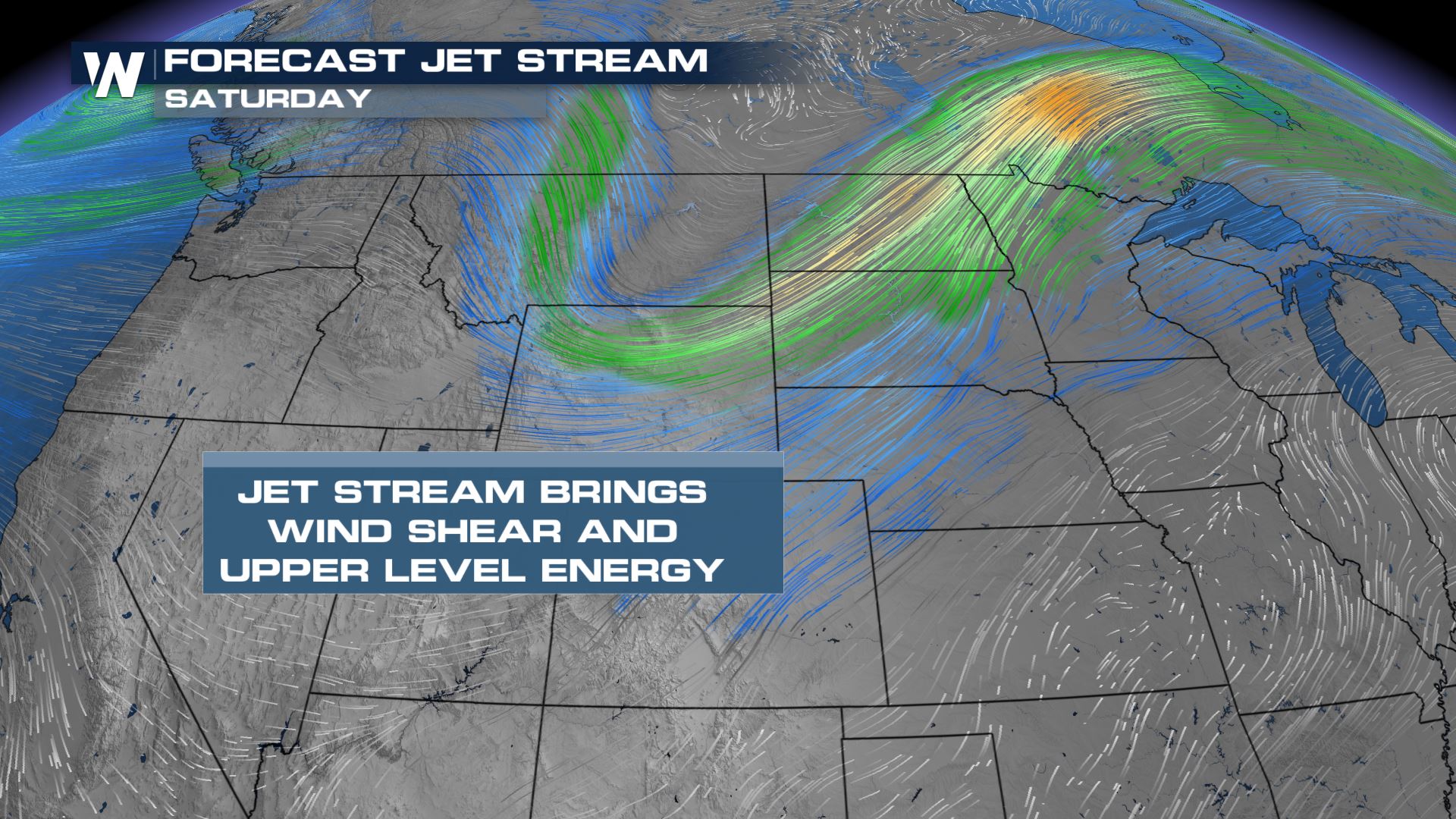
Shortwaves of energy pushing across the northern United States have kept the pattern very active, especially for the north central plains. However, the higher terrain of the Rocky Mountains help to enhance storm development closer to the *very* high plains of the country. For more on the focused forecast over the next few days, read below:
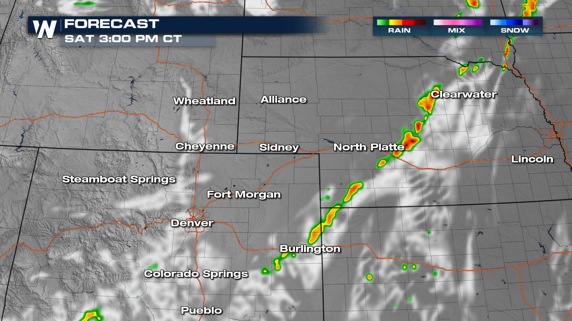
Saturday
The same energy that provides the severe weather risk on Friday to parts of Montana will graduate into a large cold front on Saturday, stretching the severe weather threat from the upper Great Lakes back to the I-25 corridor.
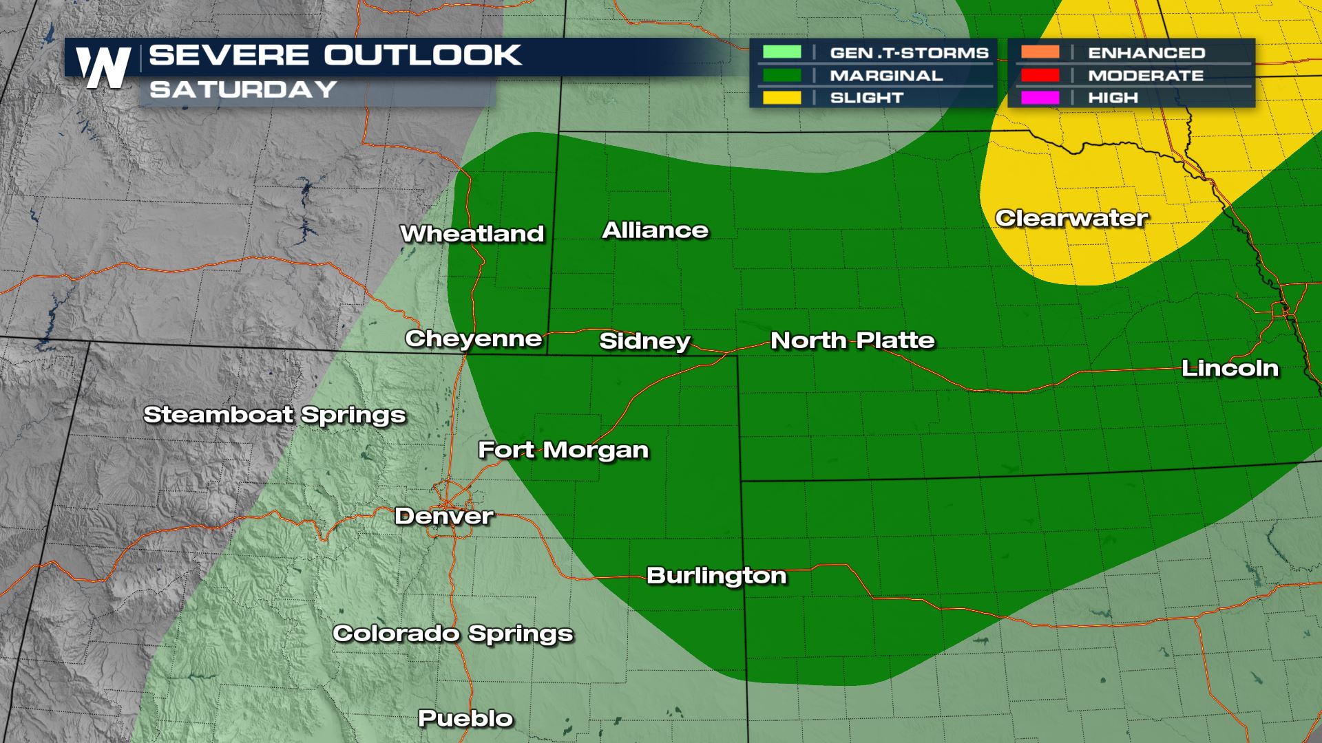
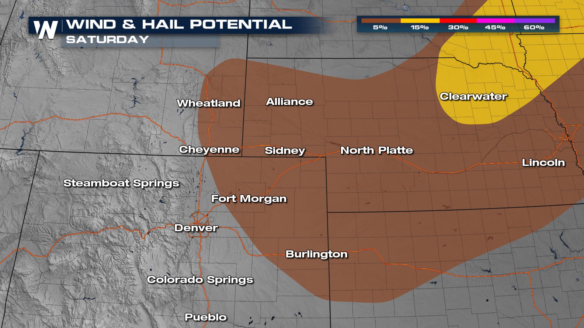
We will be watching as storms develop along this front on Saturday afternoon, closer to the Front Range of Colorado and Wyoming.
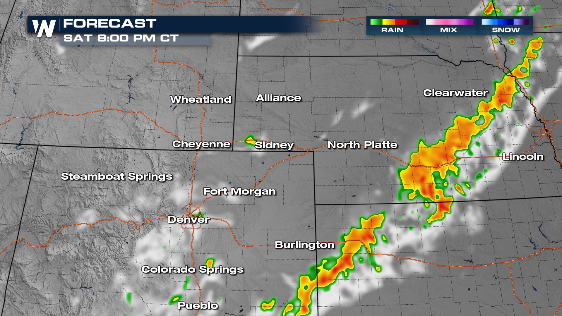
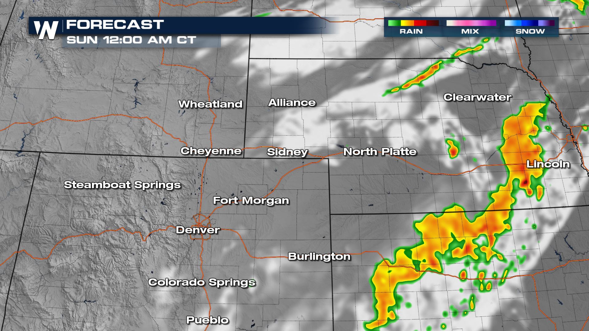
As the night progresses and the front pushes east, the severe weather risk will begin to impact Nebraska and Kansas. All modes of severe weather will be possible, so make sure you have a way to get alerts on a Saturday evening.
For more on the severe weather potential, join WeatherNation for your West regional forecast at :50 past the hour, and your Central regional forecast :30 past the hour, every hour.