All Weather News

Coastal Low Brought Heavy Rain & Wind to the Atlantic Seaboard

The remnants of Ian coupled with the onshore flow and moisture in the atmosphere contributed to an active forecast from the Mid-Atlantic  through southern New England. Heavy rain fell across the Mid-Atlantic and Northeast this week, which led to flash flooding and coastal flooding. Several locations around the Tri-State area received record rainfall Tuesday!

Other parts of the Northeast recorded high rain totals too, with some of the higher reports over 3″!

More rain fell Wednesday, but was lighter and more pinned toward the coast as the low started to move back out to sea. However some spots received more than 7″ of rain earlier in the week!

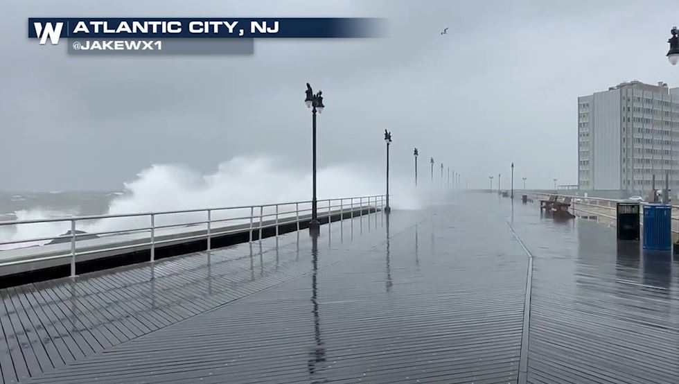
Rain chances may be ending as the low pulls away from the coast, but gusty winds continued Wednesday.

It will still be breezy Thursday on the back side of the low pressure system. There are also widespread marine alerts for the immediate coastline of the Eastern Seaboard. If you are planning to head out on the water be prepared for large swells.

Wave heights will decrease as the center of the low moves away from the coast. By Thursday afternoon most waves will be between 3-4 feet along the immediate shoreline.

Stay with WeatherNation for the latest updates on the Eastern Regional forecast, always :10 past the hour.

About the author
Kara has always been passionate about weather and knew from an early age that she wanted to become a meteorologist. Living in different regions of the country and experiencing weather events ranging from ice storms to tornadoes drove her to pursue a bachelor's degree in meteorology from the University of Oklahoma. Throughout college, storm chasing became a regular event for Kara, where she saw fir... Load Morest-hand the power of the atmosphere. Kara graduated cum laude from OU and decided to further her meteorology education with a Master's degree from Mississippi State University. The deadly April 27, 2011 tornado outbreak struck while Kara was studying at MSU; her first “Dixie Alley” tornado event and an up close glimpse into the destruction of the storms she so closely studied. Her broadcast career began in Elvis’ birthplace, Tupelo, Mississippi, where she earned her Certified Broadcast Meteorologist seal from the American Meteorological Society. Kara's career has included coverage of all types of severe weather including tornado events, flooding and tropical systems across multiple southern states. Recently she helped cover the 2020 Easter Sunday deadly tornado outbreak in southeast Mississippi. In her free time, you can find Kara outdoors exploring new areas with her mini poodle,Truffles. Kara is also an avid runner and frequently races in 5Ks, 10Ks and half marathons. Say hi to Kara on Twitter and Facebook!