
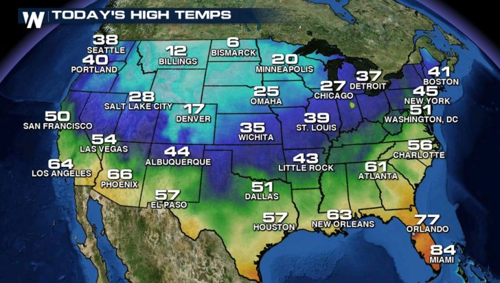
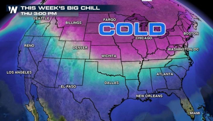
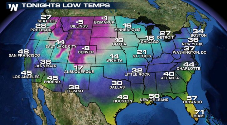
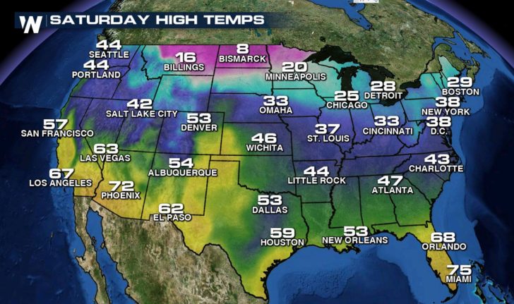
After a mild Autumn and November, the first wave of colder than average temperatures are starting the move southward from Canada. Readings will drop through most of the country, east of the Rockies, into this weekend. Highs in the Upper Midwest were only in the single digits today, especially in areas with fresh snow cover.
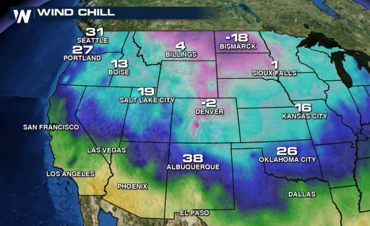
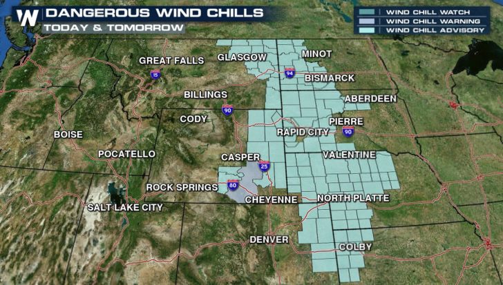
A strong breeze will come along with the plunge of cold air, dropping wind chills to bitter levels in parts of the Plains and Front Range. By this afternoon, wind chills were already falling below zero in the Upper Midwest. Wind Chill Advisories and Warnings have been issued.
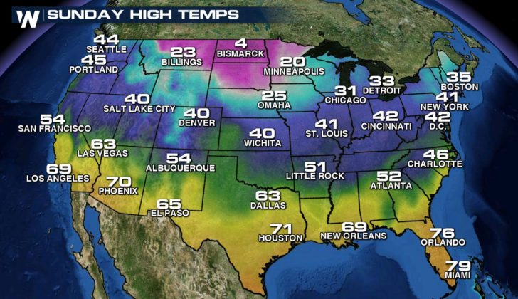
The cold air is dropping south all the way to the border of Mexico. Freeze warnings have been issued in Texas for temperatures that will plummet below freezing tonight and again tomorrow night.
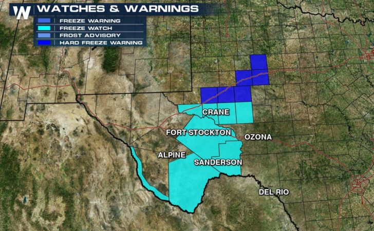
Hard Freeze Warning for parts of the upper Colorado River Valley and Permian Basin overnight! Protect pets, pipes, and plants! #txwx pic.twitter.com/3y0adwb98y
— NWS Midland (@NWSMidland) December 7, 2016
Freeze Watch in effect Friday Morning for the Presidio Valley, Big Bend, and Ward, Pecos, Crane, Upton, Reagan, and Terrell Counties. #txwx pic.twitter.com/NceDkwJGkA
— NWS Midland (@NWSMidland) December 7, 2016
Lows will fall below zero tonight for the first time this season in many locations of the Northern Plains and along the Front Range. Highs will be slow to recover Thursday.
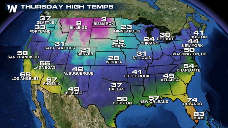
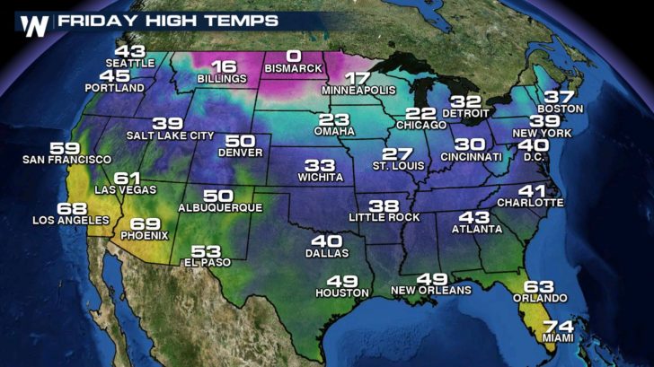
The cold air will slowly creep to the east and south, working across the Great Lakes, Tennessee Valley, and Northeast into the weekend.
For WeatherNation: Meteorologist Mace Michaels