Earlier this morning, light precipitation came down across the upper Midwest, in the form of rain, a wintry mix and even a light snow.
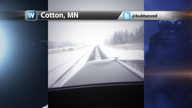
A coating of snow down on the roadways of Cotton, MN, where @bubbasved on twitter shared with us his view from his truck. Cotton, MN is located north and west of Duluth, MN.
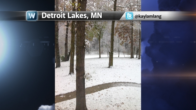
In Detroit Lakes, MN, out across the western part of the state, there was also a good coating of snow that came down on @kaylamlang yard, making it look like a winter wonderland.
There is a storm system coming down from Canada later on today, and into Sunday, where it will bring the first measurable snowfall to portions of the Midwest for the season. Yeah, we are talking about snow and Halloween hasn’t even passed yet. But for potions of the Dakotas, Wisconsin and Minnesota, the average first snowfall typically arrives by the end of October.
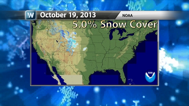
For some portions of the lower 48, snow has already moved in and put several to numerous inches of wet flakes on the ground. The Rockies out in Colorado, and the Grand Tetons in Wyoming are some of the areas that have already seen around a foot or more snowfall. The current snow cover across the Continental US equates to about 5% of the surface. We could be adding more areas in the Midwest to this map once this month is all said and done.
Lets go through the next __ hours and break down how the storm system will be moving across the area.
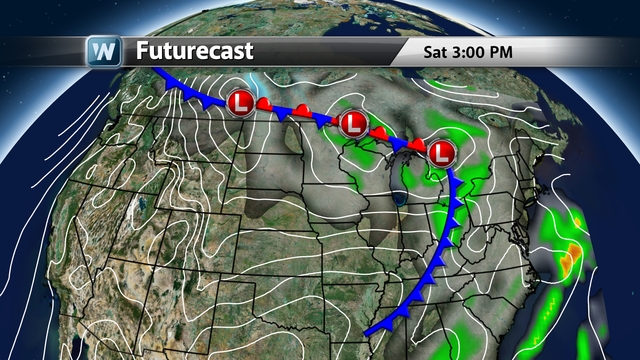
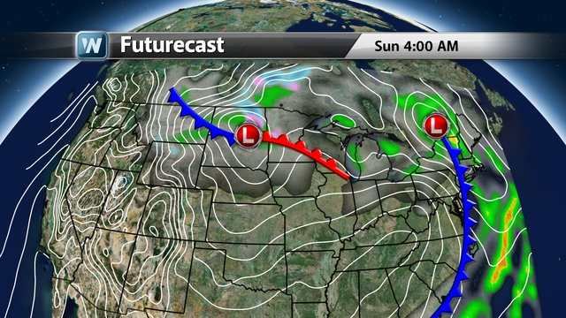
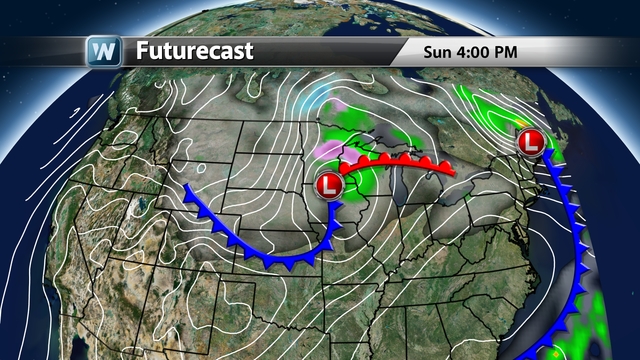
Looking at how things will be later on today, three areas of low pressure will be skirting across the upper tier of the country. One low out near the eastern Great Lakes has a cold front that has brought showers and cool conditions to the Ohio River Valley earlier today. It will be heading on its way towards the East Coast. Low #2 is bringing clouds and scattered showers to the western Great Lakes, while Low #3 is heading down from Canada and into the Dakotas.
After midnight tonight, Central Time, the second low pressure starts to fizzle out over the Great Lakes, while the first one heads up into the Canadian Maritimes and its’ associated cold front, moves to the East Coast. The upper Midwest sees signs of rain changing to a wintry mix and snow, with the third low pressure drops down from Canada.
In the northeast on Sunday afternoon, the clouds will start to clear out as the area of low pressure nearby pulls further away. In the Midwest, the cloud cover will be vast while the area of precipitation will be small. Clouds look to cover from portions of Kansas and northward while the rain/sleet/snow, is located in portions of Iowa and up to the Canadian border. A transition period from rain, to sleet, to snow, and back again will occur from the overnight to the mid-day hours across Minnesota, the Dakota, and Wisconsin.
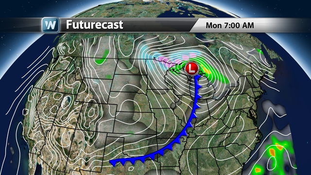
And come around the Monday morning hours, the winds will really start streaking down out of Canada, across the upper Midwest and into the Central Plains and to the Great Lakes, as that area of low pressure digs deeper into the atmosphere. Blustery conditions, combined with cloud cover, will keep numerous locations from North Dakota to Michigan, way below normal in terms of day-time highs. The snow will start to taper off but flurries and scattered mixed showers could still be blown around through the area.
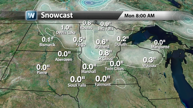
Our in-house, Adonis, model, a light coating to about 1-2″ could fall from the upper peninsula of Michigan, through Minnesota and into North Dakota. The Twin Cities could see some flurries to a dusting.
The European Model (ECMWF) wants to crank up the snow totals somewhat, by bringing 2-6″ across much of northern MN and towards the arrowhead area, 6-10″. This model time frame is through Sunday afternoon. A narrow band of a coating to an inch of snow wants to come into ND and slide down into IA. The Euro, compared to some of the other models, is shooting a little high with the snow totals.
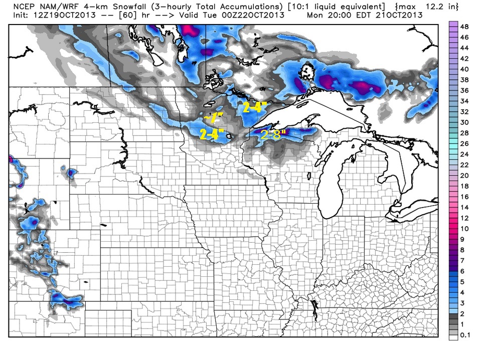
With the NAM model, the snow looks to be lighter across the upper Midwest, with most places seeing a coating to a few inches in Northern MN and slightly higher amounts across northern WI and into MI.
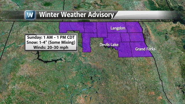
There are already a few counties in North Dakota that are under a winter weather advisory, where they expect to see a few inches of wet snow (there could also be some mixed precipitation in there as well). Just after that same time frame, the winds will start to pick up across the area at speeds of 20-30 MPH and then stay that way into Monday. The wind chill temps will be in the teens to the mid 20s, from Sunday afternoon and into Monday.
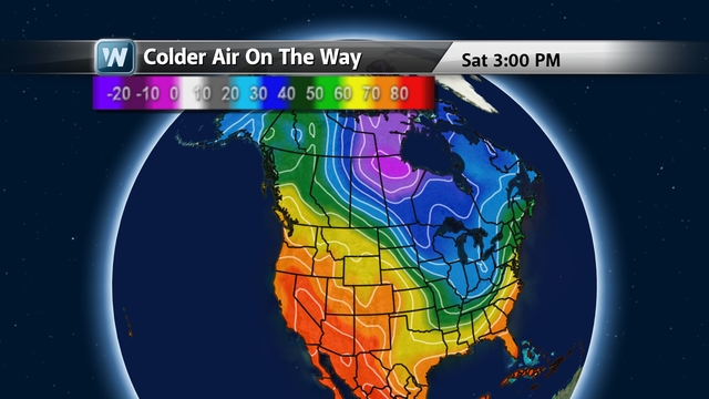
That cold air coming into the upper Midwest for this weekend looks to be the tip of the iceberg,… no pun attended. The jet stream will start to dip across the eastern half of the country, and cold air will come pouring down from Canada, and head straight into the southeast over the course of the upcoming week. Temperatures aloft (850mb) up near the Hudson Bay area trending to be very cold and even cooler than normal conditions can be found into the Ohio River Valley.
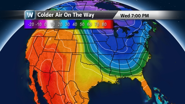
By the upcoming mid-week, temps will be trending around drastically colder than normal from the Midwest, to the southeast and up into the northeast. The warm air will be driven up into the northwest, as a ridge of high pressure builds up over there, with the jet stream lifting up past the Canadian border. These are the temperatures about a mile up in the atmosphere (850 mb) and not the surface temps.
Keep checking us out here at weathernationtv.com and tuning in for the latest information on the Midwest snow and this first big blast of chilly, Canadian air.
Meteorologist Addison Green (twitter: @agreenWNTV)
