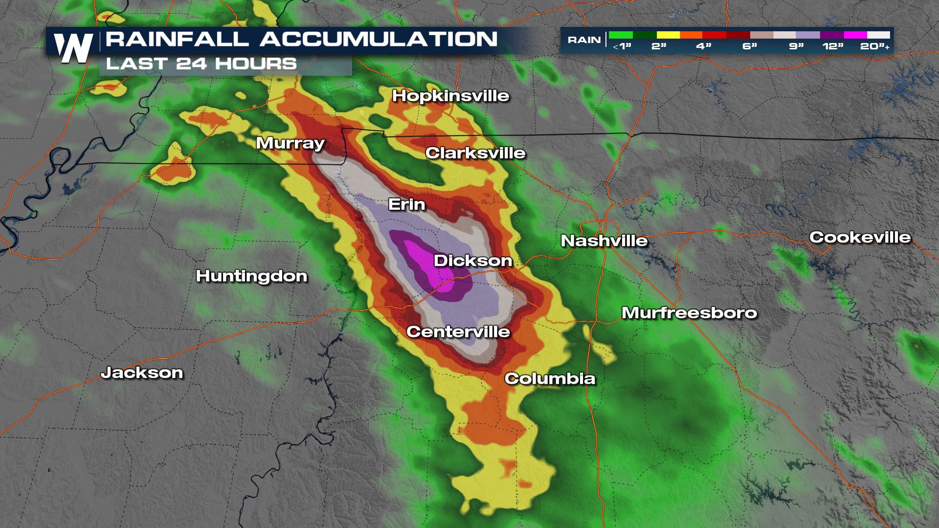
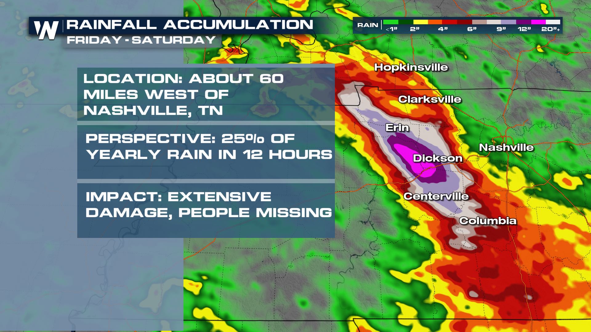
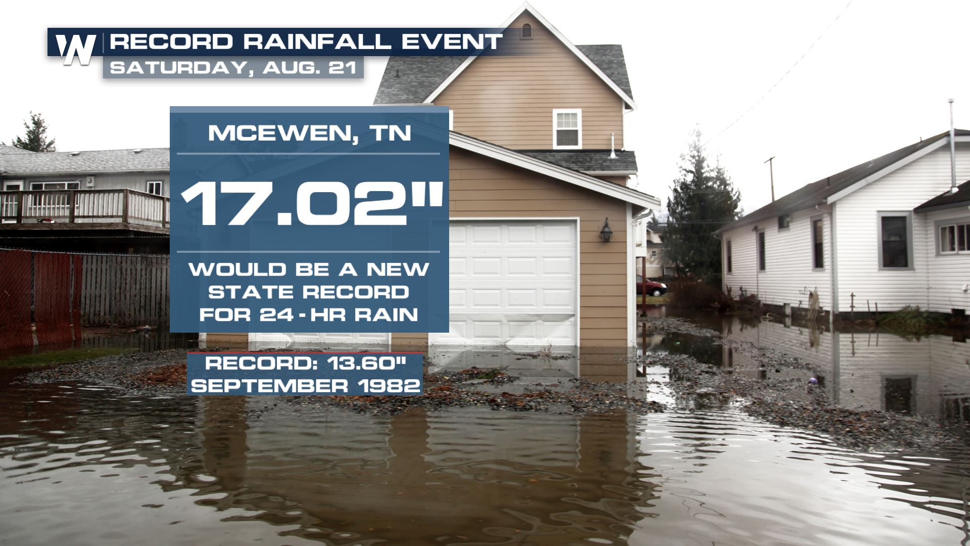
A complex of torrential rain and thunderstorms unloaded on portions of West Central Tennessee and Southwestern Kentucky on Saturday. As much as 9 inches of rain fell during a 6 hour time span, with as much as 11 inches in some isolated areas, and possibly one report of over 17″ (this particular report is under investigation by the National Weather Service to verify its accuracy). All of that rain led to multiple water rescues, homes being carried off their foundations, and tragically is responsible for taking the lives of at least 22 individuals.
Drone footage from our field correspondent shows the chaos all of this has left in the town of Waverly. It looks more like tornado damage as opposed to a flooding event.
We have more heartbreaking footage from #Waverly, #Tennessee.
Our field correspondents will be on the ground covering the deadly #flooding that took place in this small community. #TNwx pic.twitter.com/gvRkrTE5sA
— WeatherNation (@WeatherNation) August 23, 2021
The National Weather Service in Nashville is calling the flooding "catastrophic" in Dickson, Houston, Humphreys & Hickman Counties. Between 8-11 inches of rain has accumulated leading to homes and businesses being completely flooded. I-40 was shut down near mile marker 153. #TNwx pic.twitter.com/wxTKfFy2UA
— WeatherNation (@WeatherNation) August 21, 2021
The National Weather Service in Nashville called the situation, “catastrophic.”
This is a catastrophic flooding situation.
An estimated 8-10"+ of rain has fallen in Houston, Humphreys, Dickson & Hickman Counties thru 8 AM.
Rain continues with locations reporting 11"+ with locally higher amounts very likely. Special thanks to @NWSMorristown for the graphic. pic.twitter.com/N2yk2mqezT
— NWS Nashville (@NWSNashville) August 21, 2021
The flooding led to the closure of I-40 near mile marker 153, in addition to the Piney River in Vernon topping it’s historical crest by more than 10 feet.
The river gauge on the Piney River at Vernon is indicating a level of 31.8 feet. This well exceeds the historic crest of 20.08 feet set on February 7, 2019.
The dangerous flooding situation across western Middle Tennessee continues, even as rain dissipates this morning. https://t.co/3lDbIUL35w
— NWS Nashville (@NWSNashville) August 21, 2021
Less rain is expected across central Tennessee in the coming days, allowing time to clean up and for search & recovery efforts.