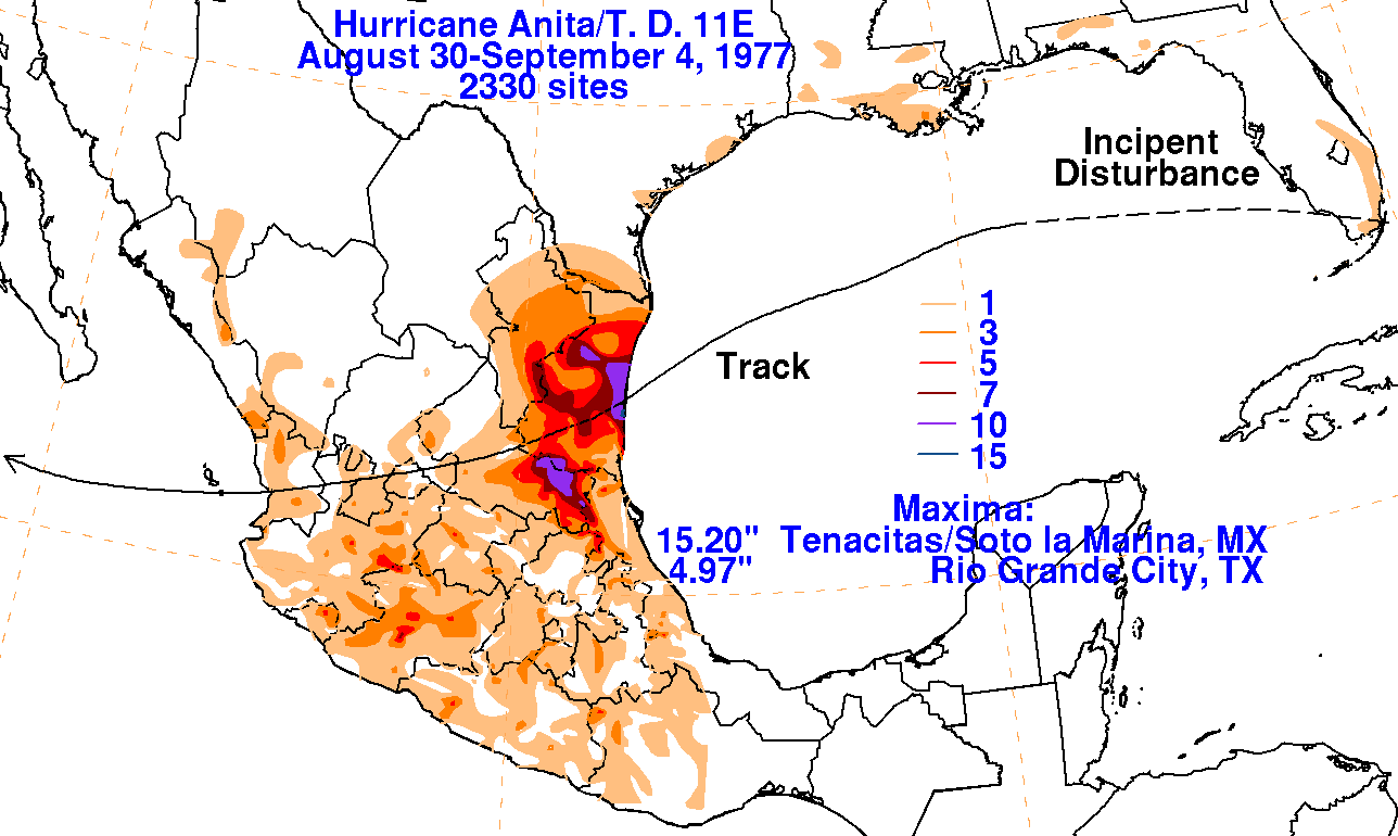
[Written by NOAA] On August 16, 1977, a tropical wave moved off the coast of Africa. It wasn’t until nearly two weeks later that the wave developed enough convection and a surface circulation, and was designated a tropical depression in the middle of the Gulf of Mexico. As it neared the Caribbean Sea, the track became more west-northwest. On the 23rd, it moved under an upper-level cold low. By the 27th, the associated weather moved north of the upper cyclone, which had spread across the Bahamas and Florida. On the 28th, the disturbance moved into the eastern Gulf of Mexico, and organized into a tropical depression on the 29th about 200 nautical miles south-southwest of New Orleans, a tropical storm on the morning of the 30th, and a hurricane that night.
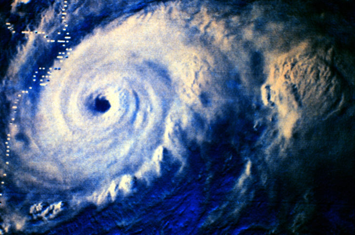
The system slowly moved west-southwestward, but rapidly intensifying into a category-5 hurricane with maximum sustained winds of 175 mph just two days later. Anita made landfall September 2nd at Soto la Marina, Tamaulipas, on the Mexican Gulf coast as a category-5 hurricane, producing 15.20″ of rain. Though the region of greatest impact was sparsely populated, 11 deaths were reported, and 25,000 were left homeless by the hurricane.
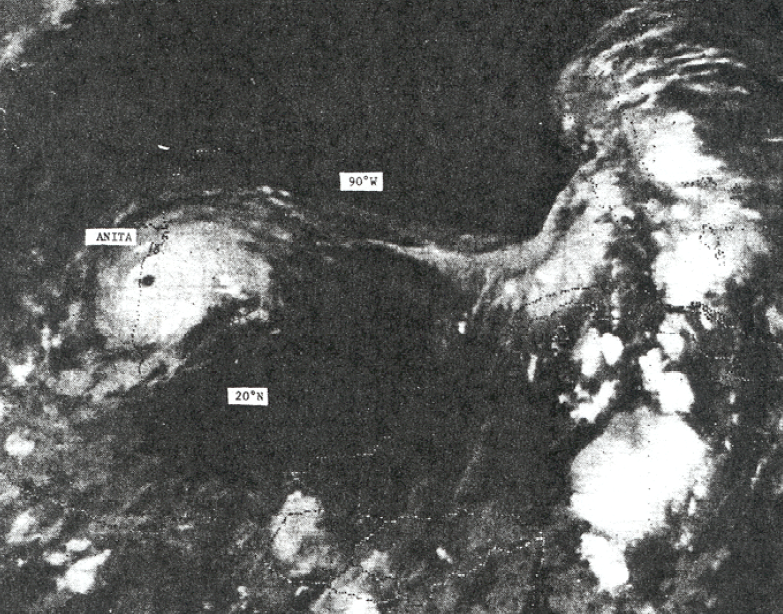
The system emerged into the eastern Pacific and was re-designated Tropical Depression 11. The depression moved quickly westward and dissipated after passing south of Baja California on the 4th.
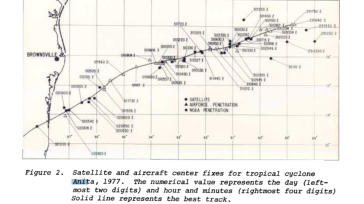
Anita marked a number of firsts for NOAA. NOAA had recently acquired two new Lockheed WP-3D aircraft for hurricane research, and they were both deployed into the storm, marking the first hurricane flights for these planes. In addition, ground-based radar located in Brownsville, TX, noted a double eyewall feature that Hugh Willoughby, later director of HRD, instrumental in his development of the theory of concentric eyewalls and eyewall replacement cycles.

Scientists at what eventually became HRD studied the data from these early flights for many years resulting in several published papers.
Edited for WeatherNation: Meteorologist Mace Michaels