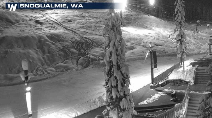
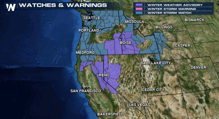
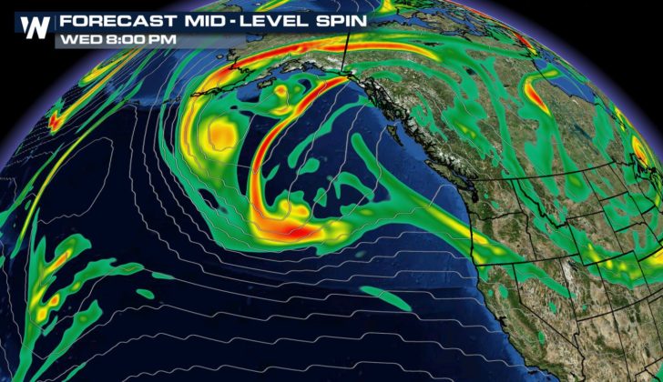
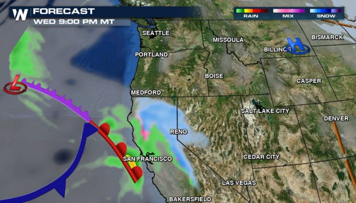
More snow is on the way in the west this week as another storm system moves in from the Pacific Ocean. Totals in several of the mountain ranges will likely be well over a foot by this weekend. The Cascade, Olympic, Sierra, Bitterroot, and Wasatch ranges will see the most snow. Winter Storm Watches have been issued from California and Washington to Utah and Wyoming. An upper level low pressure system will begin to push energy aloft into the west by later tonight.
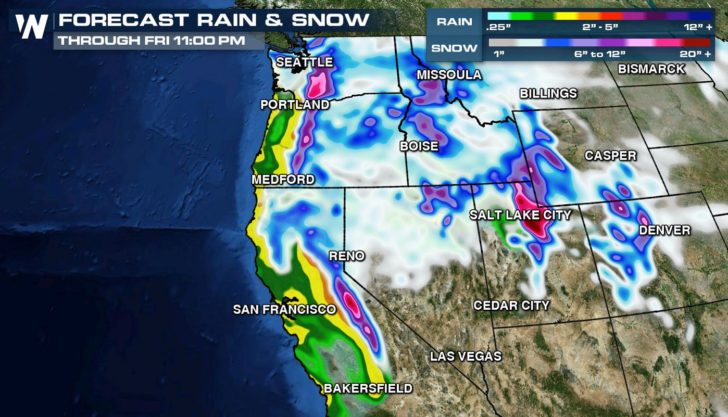
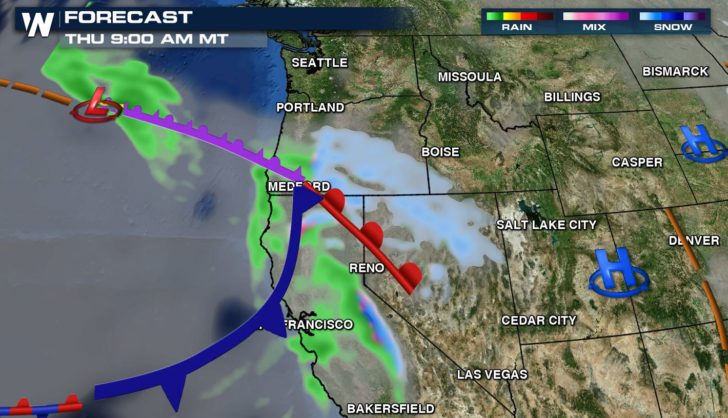
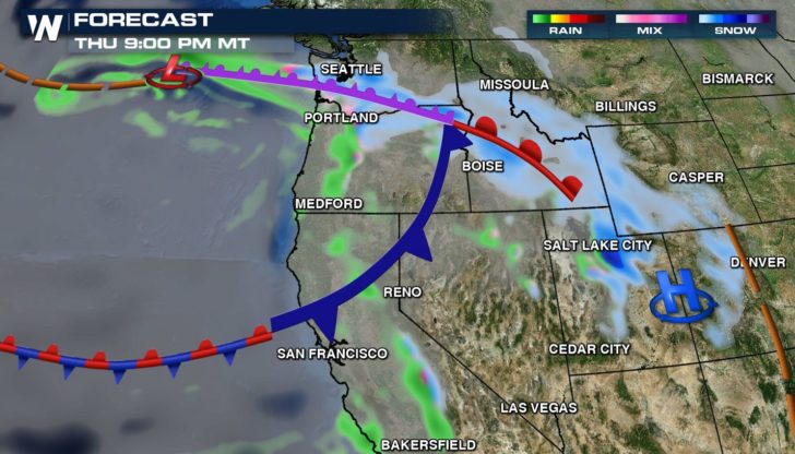
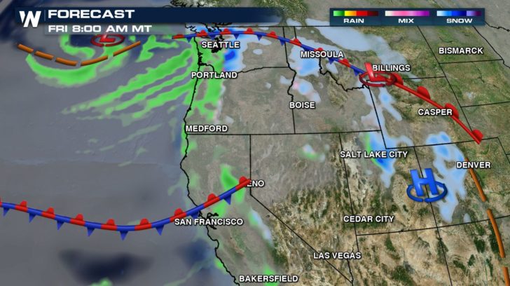
The storm will be slow moving, pushing into California and Nevada tonight. The snow will spread across the rest of the western states Thursday and Friday.
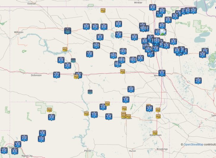
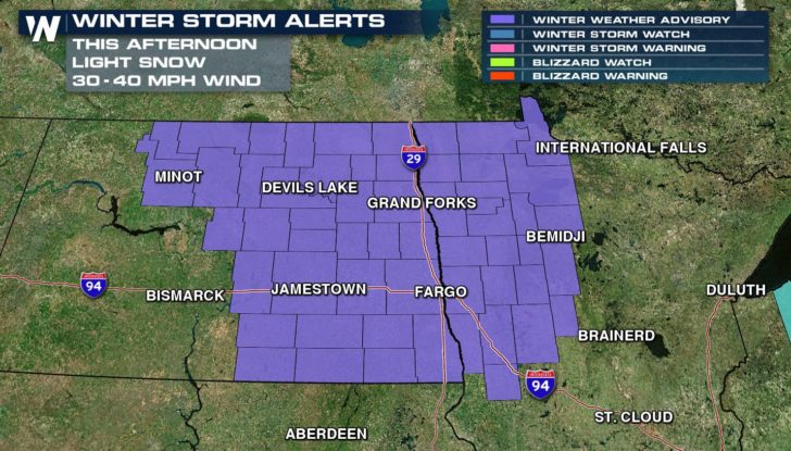
Snow is finally starting to come to an end in North Dakota after more than a foot of accumulation since Sunday. The wind remains brisk, creating areas of blowing and drifting snow. Visibility has improved from this morning and Blizzard Warnings have expired and replaced with Winter Weather Advisories.
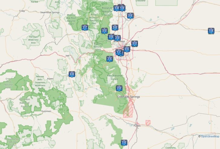
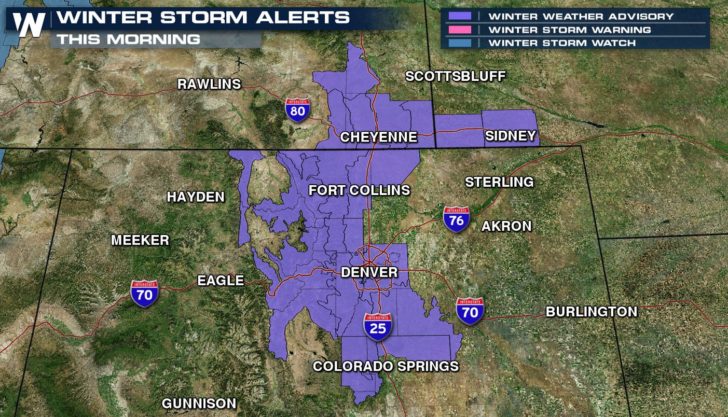
A quick burst of snow fell in Colorado Tuesday afternoon into this morning. It is decreasing and should come to an end this afternoon. Up to 6″ of snow fell in a few areas, creating traffic issues from Denver to Colorado Springs.
For WeatherNation: Meteorologist Mace Michaels