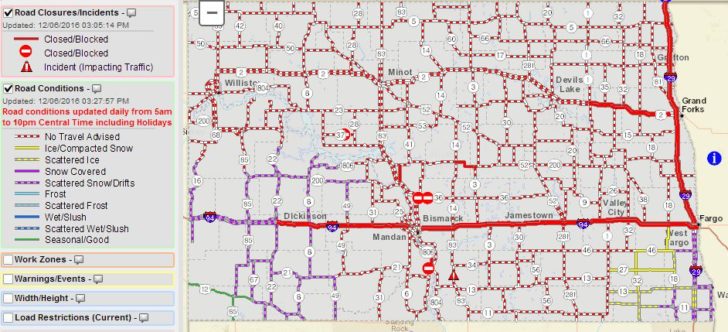
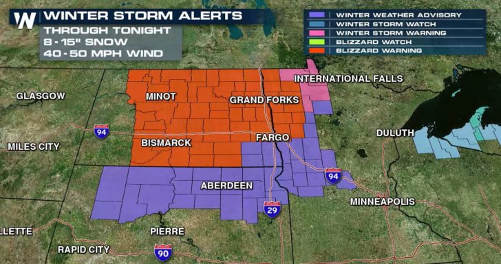
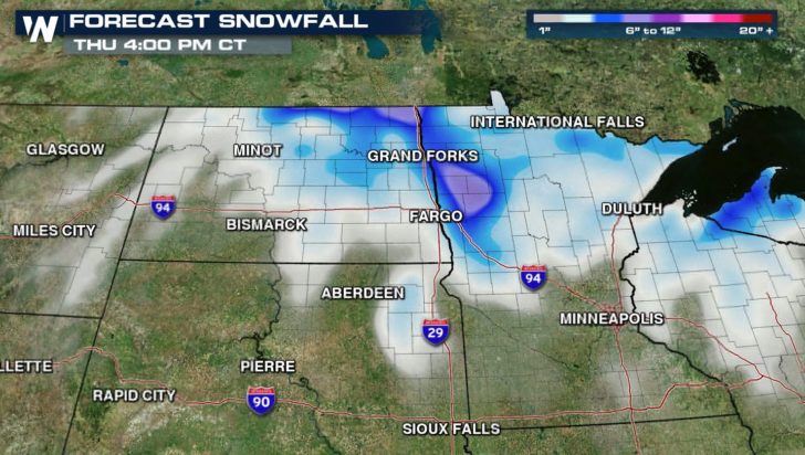
Strong wind and heavy snow continues across Northwest Minnesota and Central & Eastern North Dakota. Near zero visibility has been reported, and most rural roads in North Dakota are closed or travel is not advised. Blizzard Warnings and Winter Storm Warnings continue over most of the region.
I-94 eastbound & westbound CLOSED Fargo to Dickinson; I-29 northbound & southbound CLOSED Fargo to Canadian border https://t.co/QsV2hpugba
— NDDOT Fargo District (@NDDOTFargo) December 6, 2016
US Highway 2 will close from Lakota to Devils Lake at 4:30 p.m.
— NDDOT Williston (@NDDOTWilliston) December 6, 2016
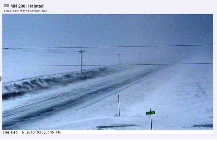
Most traffic cameras in North Dakota and Northwest Minnesota show difficult travel conditions with significant blowing and drifting snow.
Snow on roads and high winds in NW Minn. Hwy 2 SE of E Grand Forks on left. Hwy 171 St. Vincent. Difficult conditions there. Plan ahead. pic.twitter.com/FCFidM4UwO
— Kevin Gutknecht (@kggutknecht) December 6, 2016
A few road cams showing the terrible travel conditions. From left to right: Cavalier, Drayton and New Rockford. pic.twitter.com/1qqS0Dtwgh
— Tom Szymanski (@tallweatherguy) December 6, 2016
Sterling, ND web cam. Blizzard! #ndwx #blizzard pic.twitter.com/jtFAqVE79v
— NWS Bismarck (@NWSBismarck) December 6, 2016
Denhoff, ND web cam. Dangerous travel! #ndwx #blizzard pic.twitter.com/dbeplG8ObI
— NWS Bismarck (@NWSBismarck) December 6, 2016
With sustained winds of 25 to 40 mph and gusts of 40 to 60 mph, travel is dangerous to nearly impossible.
#ndwx Peak Wind Gusts Past 18-24 Hrs (West/Central ND & Surrounding Observing Sites). pic.twitter.com/whM69u00zX
— NWS Bismarck (@NWSBismarck) December 6, 2016
Highest winds so far in eastern ND #NDWX pic.twitter.com/nAlncwAzMg
— NWS Grand Forks (@NWSGrandForks) December 6, 2016
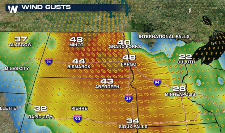
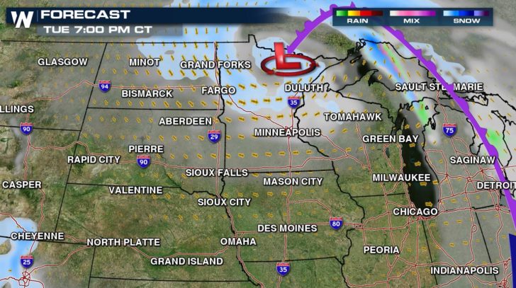
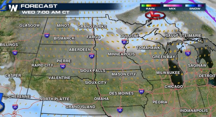
The wind is expected to remain strong throughout most of the night and into tomorrow, creating additional blowing and drifting snow.
Winds of 30 to 40 mph with gusts to 55 mph have been reported across the region. #ndwx #mnwx pic.twitter.com/HM8HuR5UTL
— NWS Grand Forks (@NWSGrandForks) December 6, 2016
This evening's wind forecast showing winds expected to stay strong. #blizzard #mnwx #ndwx pic.twitter.com/6F8BB7qnNo
— NWS Grand Forks (@NWSGrandForks) December 6, 2016
Another 3 to 6″ of snow will fall as the low pressure center starts to move into Northwest Ontario. It will take some time for road conditions to improve, especially in rural areas
From WeatherNation: Meteorologist Mace Michaels