Significant Icing Event for the Plains and Mid-Mississippi Valley
Ice, Freezing Rain, or Sleet?
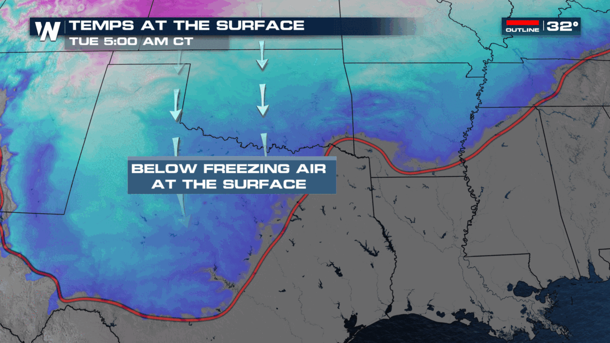
Cold air is making its way south through the Lower 48 early this week; where freezing temperatures meet Gulf of Mexico moisture, a significant and prolonged icing is underway. Mild and muggy air from the Gulf of Mexico is riding up and over cold, dense air along a boundary from Texas to the Mid-Atlantic. Although the precipitation initially falls from the clouds as snowflakes, this warm layer of air causes the flakes to melt. Those raindrops will then fall into a shallow layer of freezing air before reaching the ground. Where this layer is thick enough for the drops to partially or fully re-freeze, sleet (small ice pellets) accumulate; but where the layer is too thin for the liquid to solidify, those drops freeze on contact with surfaces. This is called freezing rain.
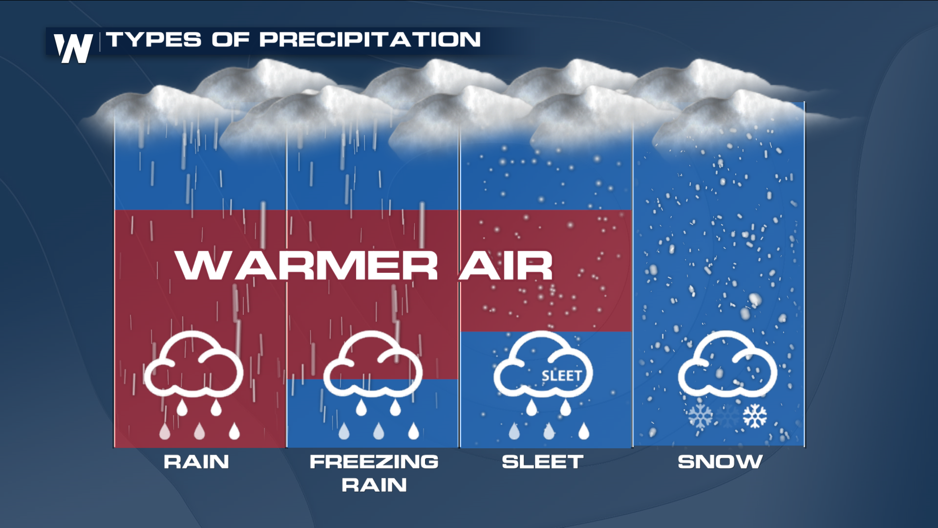
Multiple energy waves will ride along the boundary from Texas to Kentucky this week. Each batch of precipitation will bring the potential for additional impacts so please plan your travels accordingly and try not to be on the roads when the worst weather is impacting your area. It’s all about that temperature profile: in this case, surface temperatures are well below freezing, but with a warm nose of air in the 850 MB layer of the atmosphere (about 5000 feet above the ground), temperatures are above freezing. This leads to freezing rain or sleet.
What We’ve Seen
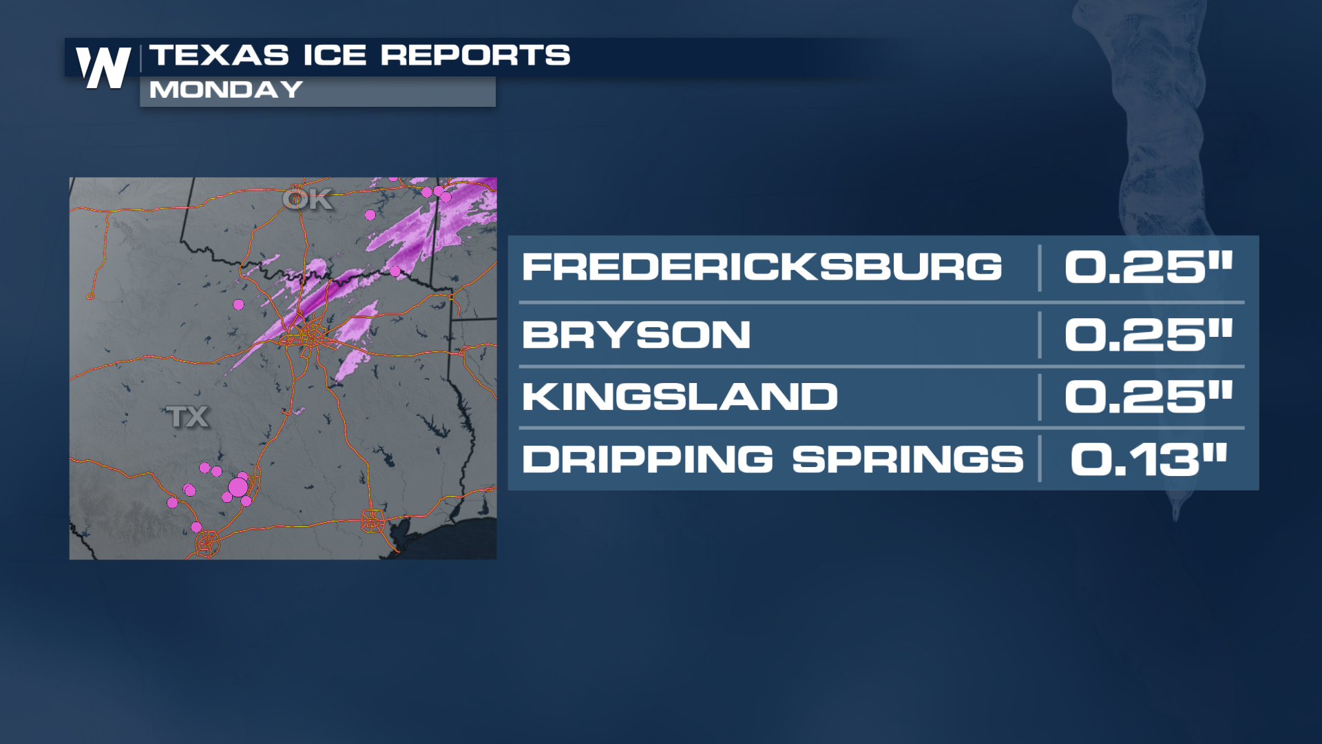
Numerous reports of icing have already caused problems on the roads including scenes like this in north Texas:
There is traffic trouble all over the Dallas-Fort Worth metroplex today due to icy roadways! If you must travel, take it slow and leave plenty of stopping distance to the car in front of you. pic.twitter.com/cJsg0UHAaa
— WeatherNation (@WeatherNation) January 30, 2023
Ice reports continue to fill in across the Ozarks, the southern Plains, and the Midwest.
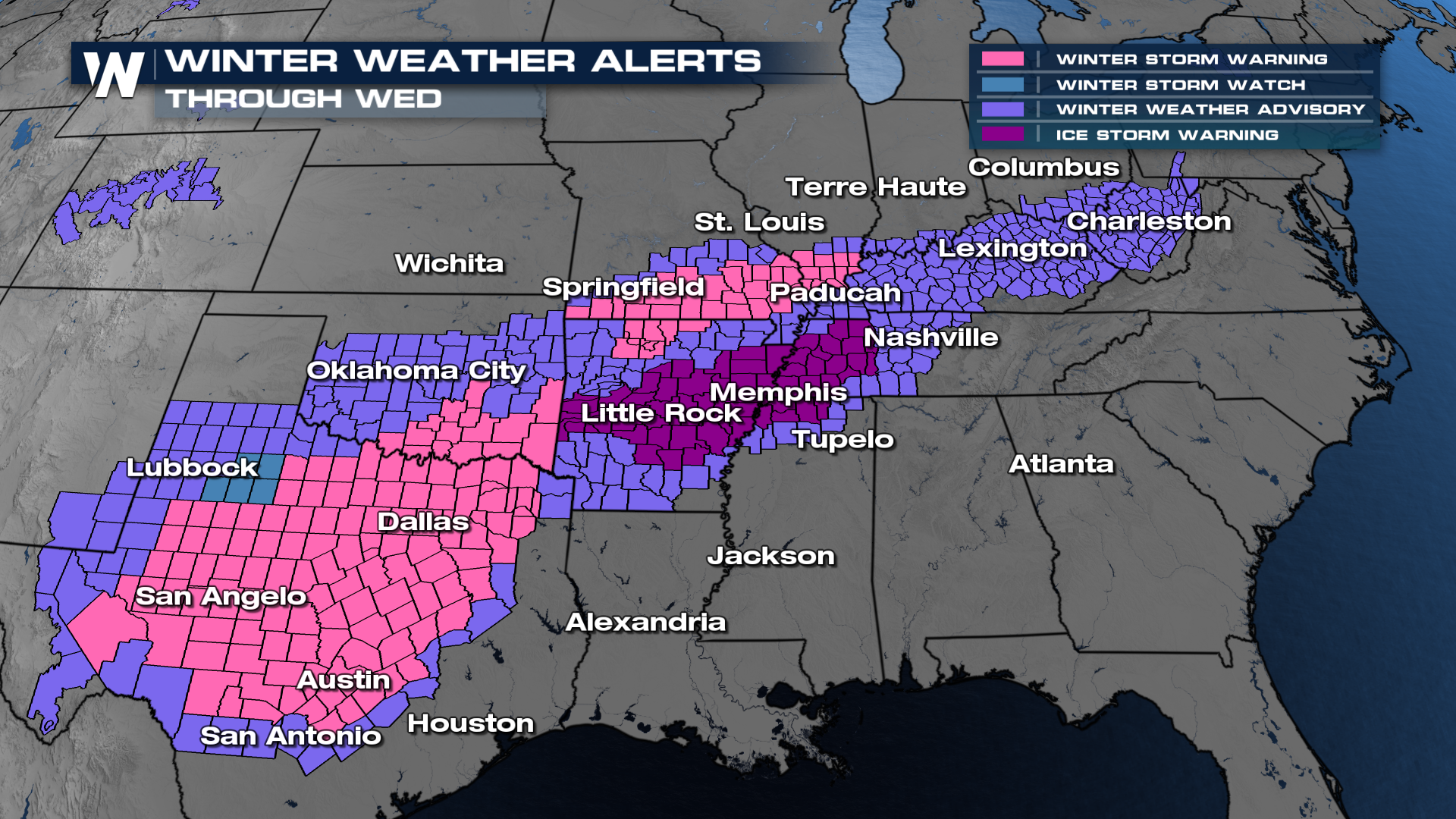
Winter Alerts
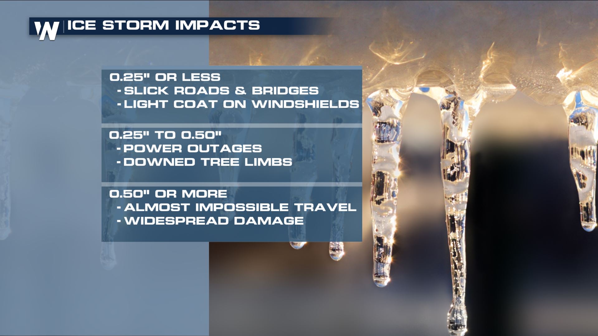
Freezing rain has created a glaze of ice on the roads, making for slick driving conditions. That ice is also accumulating on trees and power lines leading to damage to infrastructure and power outages from the weight of the ice. Winter Weather Alerts stretch from Texas through the Mid-Mississippi Valley, and into the Appalachians through Wednesday as a result of the icing event. The dark purple ICE STORM WARNINGS carry through Wednesday morning for the heaviest, most repeated rounds of icing.
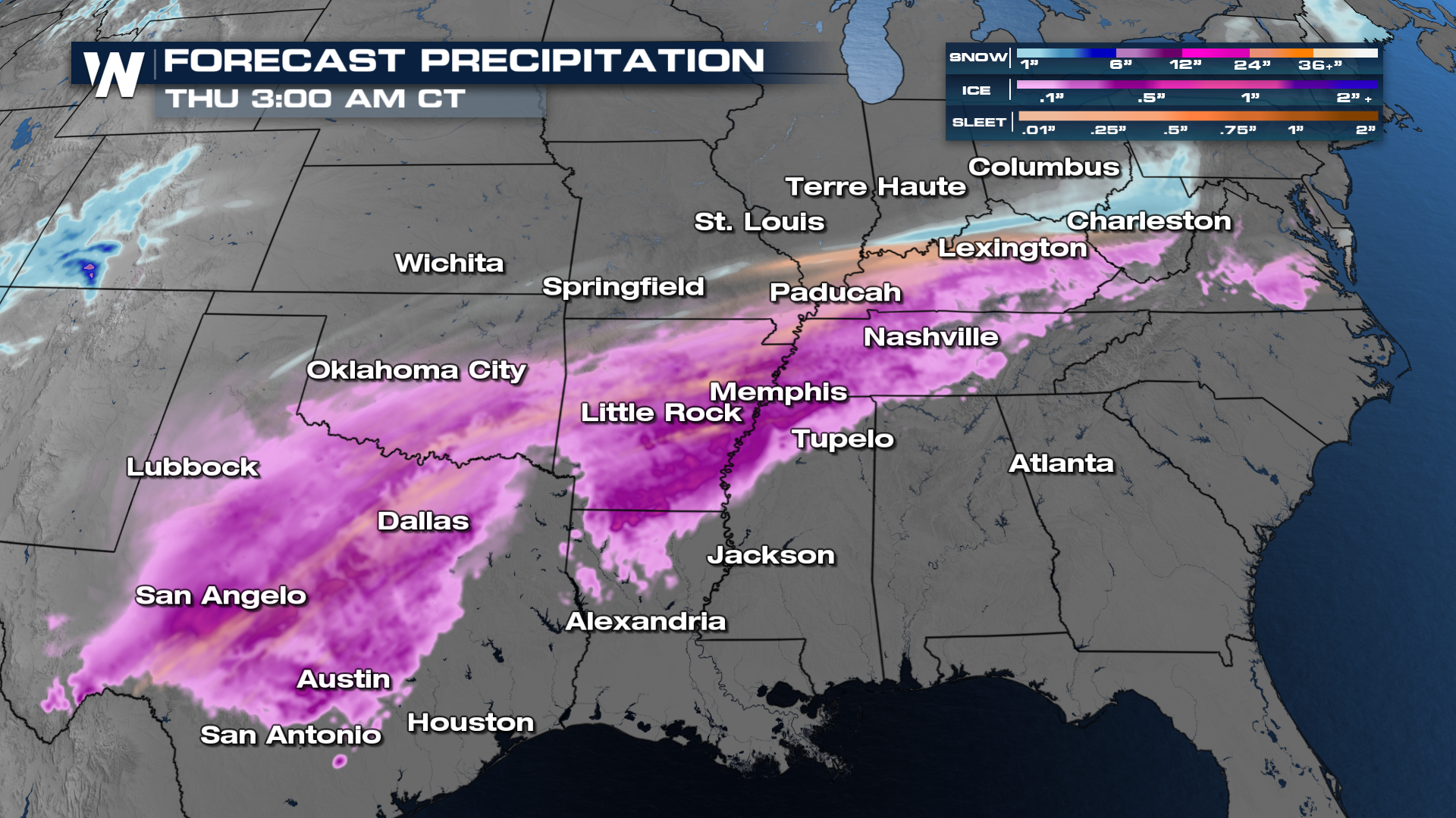
Forecast Timing
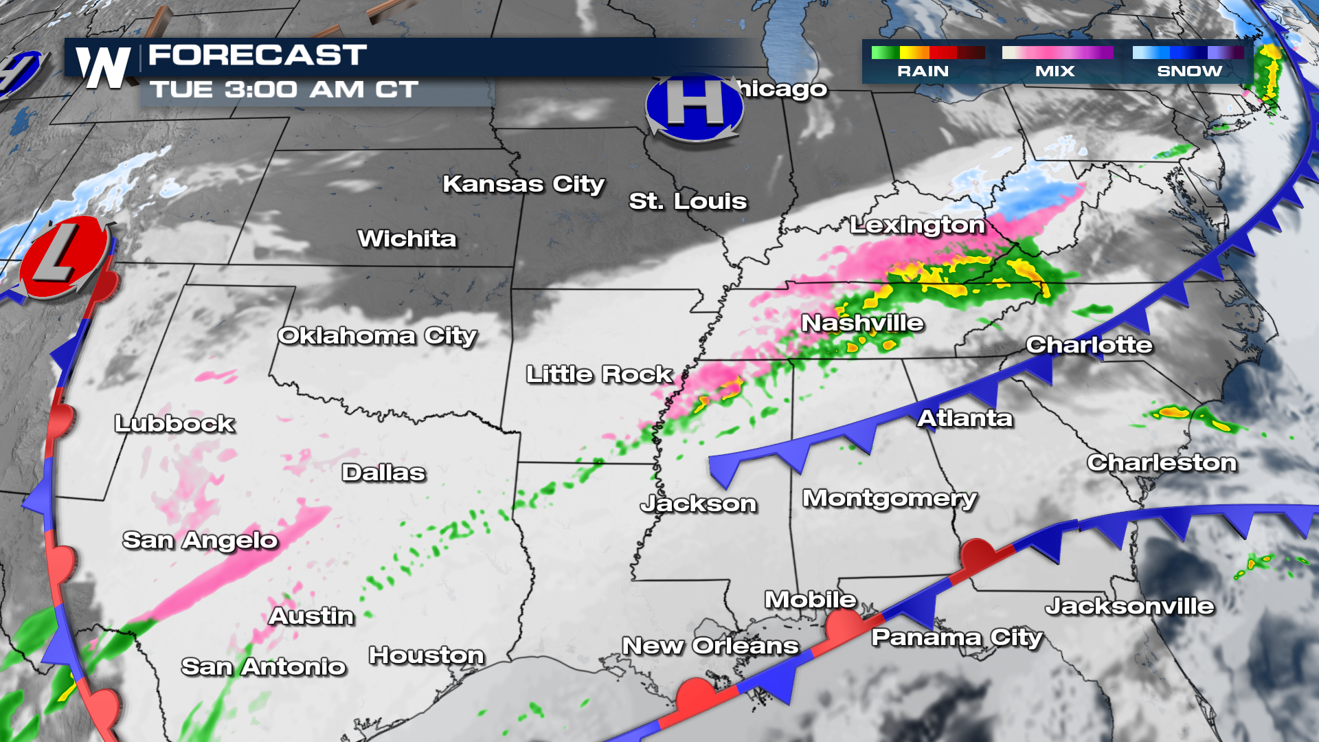
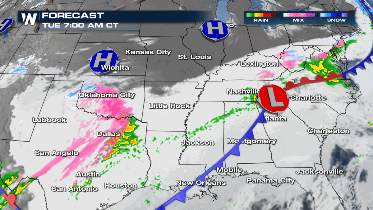
Ice impacts overnight will be felt through the I-20 and I-40 corridors of Louisiana, Mississippi and Tennessee. Our second wave of energy could bring more widespread impacts to Texas and Oklahoma beginning early Tuesday morning and then into Arkansas late morning, reaching Tennessee again in the afternoon. However, it appears that moisture may linger across parts of the Lone Star state into the evening so ice may be an issue in some locations for a good portion of the day.
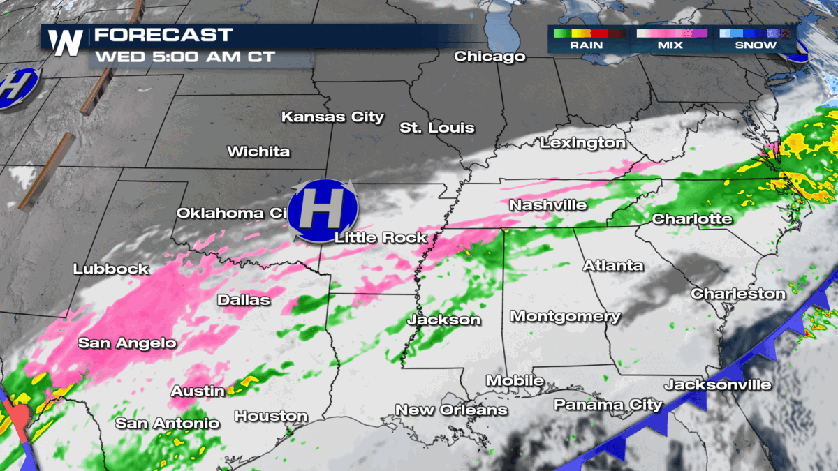
On Wednesday morning, take a look at the widespread icing in the forecast in north Texas. As temperatures warm slightly through the day at the lower levels of the atmosphere we will see a changeover back to rain rather than freezing rain through the Red River Valley.
You can always catch your Central Regional Forecast at :30 past the hour on WeatherNation!