Multiple Tornadoes Reported in the South Tuesday
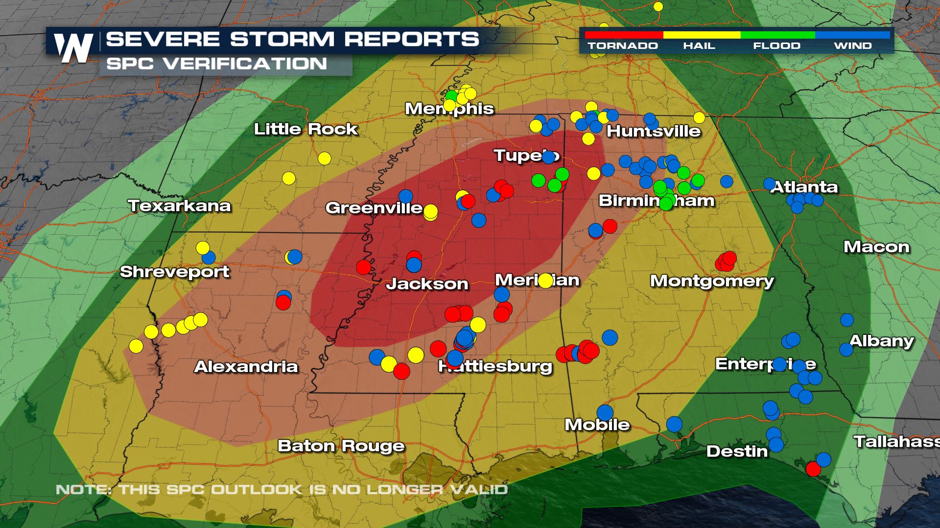
An outbreak of severe weather caused damage across the Lower MS Valley and Deep South Tuesday afternoon into early Wednesday morning. Additional severe storms are possible on Wednesday for portions of Florida, Alabama, and Georgia. The Storm Prediction Center issued a “Moderate Risk” for Tuesday into Wednesday morning, a level 4 out of 5 threat. Reports of storm damage have been added on top of the outlook (top of page) to show how the forecast verified with numerous confirmed tornadoes, wind, & hail damage.
National Weather Service offices will need to conduct storm surveys in the days ahead to determine how many tornadoes touched down, as well as their intensity. Storm spotters caught the severe weather on video, shown below, including several funnels and/or tornadoes.
CAUGHT ON CAMERA
TORNADO: A brief #tornado was caught on camera in Bassfield, MS tonight. #MSwx #ALwx #LAwx
Watch LIVE on these platforms: https://t.co/4BnsNzbPnS pic.twitter.com/kVrLrU81Gd
— WeatherNation (@WeatherNation) November 30, 2022
An apparent tornado caught on camera in Louisiana earlier this afternoon. We are tracking multiple severe storms on @WeatherNation right now! pic.twitter.com/PTHzRTdGAd
— WeatherNation (@WeatherNation) November 29, 2022
Check out this video that was taken near Jackson, AL of what looks like a potential funnel touching down in the distance!#ALwx pic.twitter.com/cPAgUgm5Bh
— WeatherNation (@WeatherNation) November 30, 2022
For more information, download the WeatherNation app, purchase and program a NOAA Weather Radio, and learn where the safe places are in your home or workplace in the event of needing shelter.